Virginia, where I topped up the fuel tank and spent the night, I set off eastward the following morning, August 2, 2022, headed for the Azores.
I’d sailed for many years but in relatively protected waters removed from the ocean, like around Puget Sound and in te channels, island passages and harbors north of there. This was my first excursion offshore, my first time being underway alone at night, but fortified by naïveté and blind faith, I sailed on into the night, asleep in my bunk with the autopilot in command. It’s only water out there, a vast ocean, nothing to run into. The first night was peaceful, the second I was awaken by a brief, intense rain squall that had me scrambling up on deck with my headlamp on to reduce sails. By the time that was done the squall had moved on and I put the sails up again.
Since those first days I’ve learned a lot about sailing, especially ocean sailing. I’ve had so many adventures that the past year seems compressed, like how could all those things have happened?
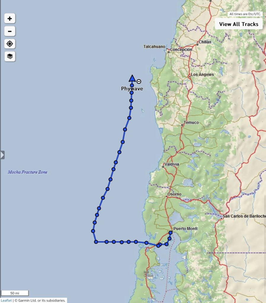
Aside from the 3 month break I took at home this Spring, I’ve spend the other 9 months alone on Phywave.I’ve landed on 4 continents (Europe, Africa, South America, and Antarctica) and in 6 countries (Portugal, Morocco, Spain, Brazil, Argentina and Chile). As I write this the boat’s trip log says I sailed a total of almost 17,000 nm. On the current passage I’ve sailed about 3,200 nm thus far from Puerto Montt with 2,200 nm remaining to arrive at Nuku-Hiva in the Marquesas Archipelago.
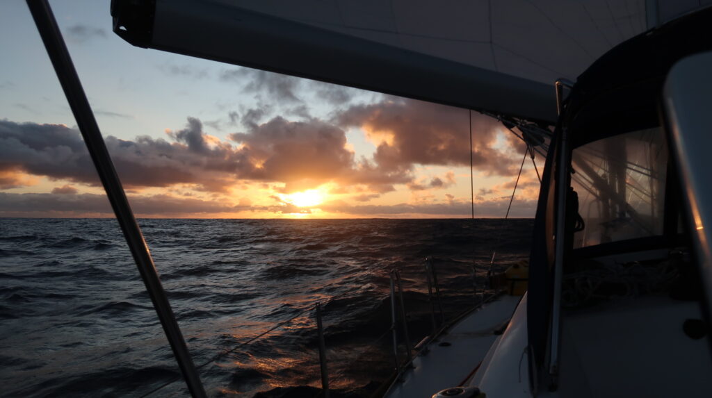
I’m sailing west across the Pacific into a setting sun,a common sailor fantasy now real, though I still see the clouds above me as a pilot would, not a sailor. With thousands of hours flying solo in my small plane all over the world, I don’t think that will ever change. I wouldn’t want it to change.
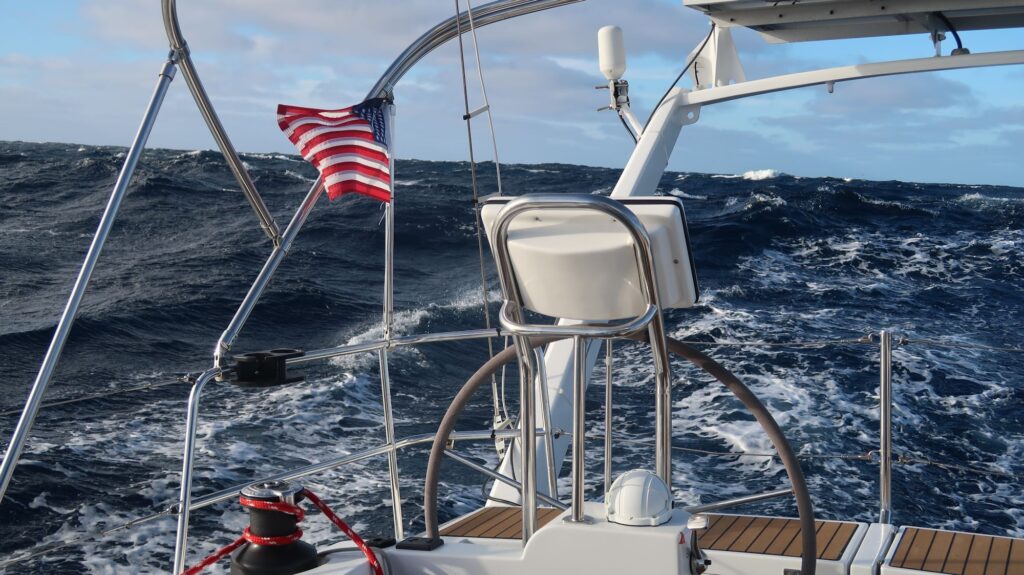
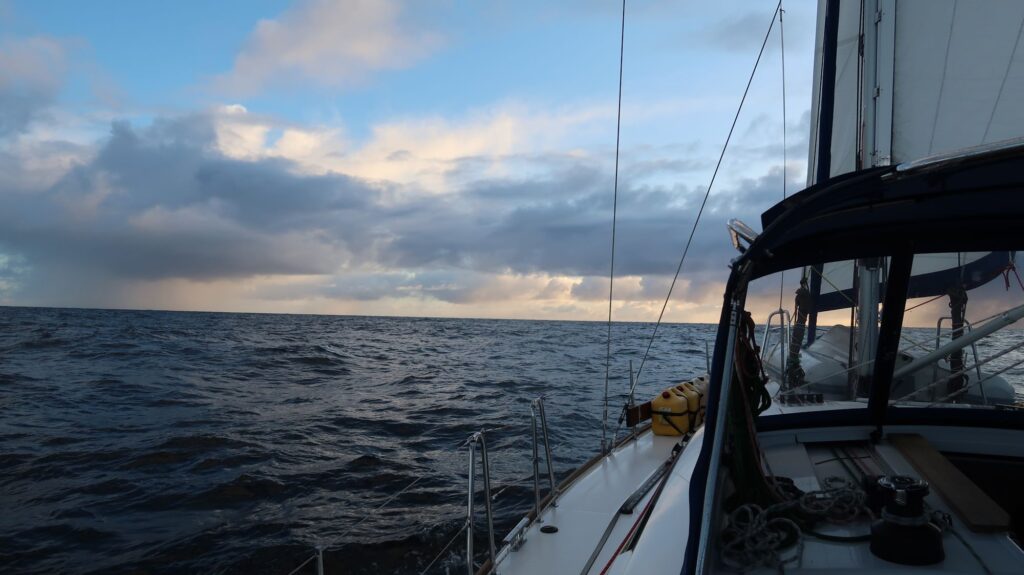
The days now on this passage are similar, flowing together with no distinguishing features, the trade wind direction and speed finally fairly steady, a sky that suddenly clouds over then just as quickly brightens to brillant blue, seemingly at random, followed by recent nights lit up with a moon waxing full. It’s the upper half of a world that has the hypnotic, twisting rythmn of the waves beneath. And me in between.
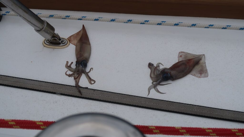
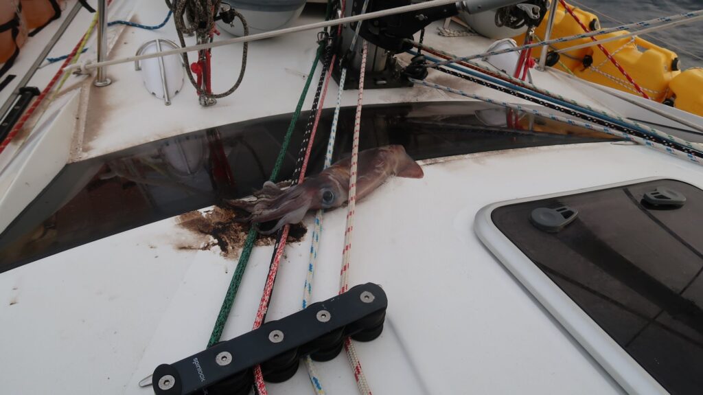
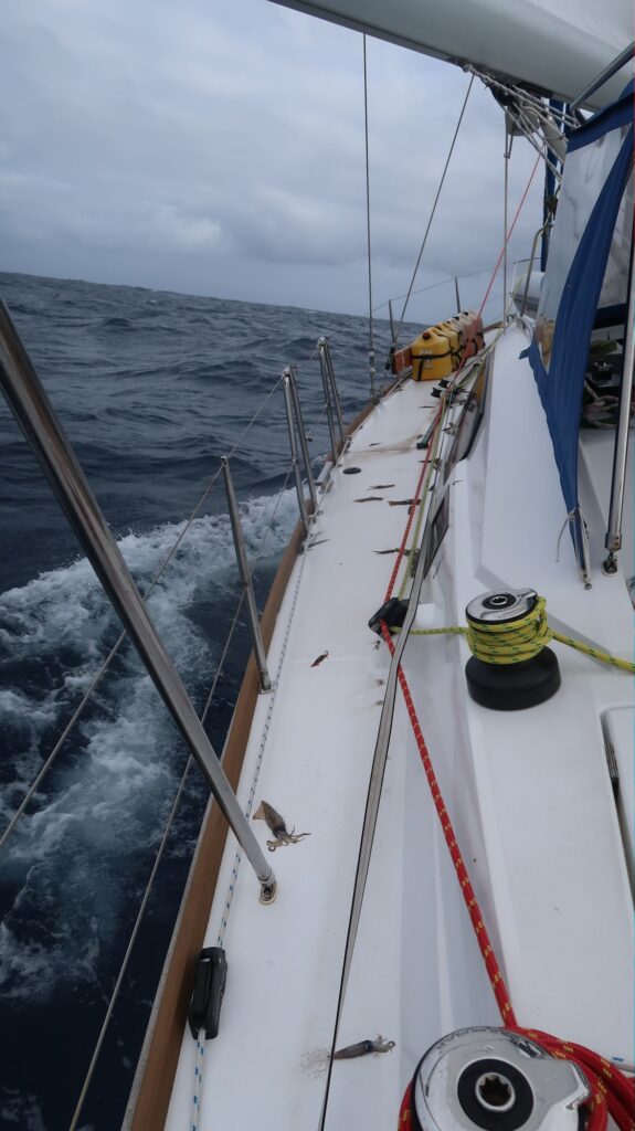
Crossing the Atlantic it was common to find dead flying fish on the deck, even in the cockpit. I’d see these fish spend a fair amount of time airborne skimming across the water so it was not a great surprise to see some of them end up on the deck. But I don’t know what’s up with all these squid that started showing up on the deck in the Pacific. They can’t fly so I assume they get tossed on deck by the waves that routinely hit the hull of Phywave and break over the deck. Most are less than 6 or 8 inches long so don’t weigh very much and water could easily toss them around. However, a few days ago a really big one landed on deck, about 18” long with tentacles, weighing over a pound. Somehow it got wedged under the headsail halyards. I tossed it overboard but now I’m hoping for a short, intense rain squall to wash the bloody mess off my deck. And as of a few days ago the dead flying fish are also back.
I’ll pass 90 degrees west longitude today, due south of the Galapagos Islands 840 miles to the north, a very interesting place I visited for a week back in 2007. From my current position there remains about 2950 nm to Nuku-Hiva in the Marquesas Islands (about 24 days averaging 5 knots). My boat trip log says I’ve already sailed 2350 nm from Puerto Montt so this will be a 5300 nm passage when I arrive there, more than twice as long as the longest passage I made in the Atlantic.
I’ve just added a new page entitled “Sailing Videos” under the Sailing section of my website www.phywave.com. These are short, unedited video clips posted on my YouTube channel that better convey the sailing experience than still photos can.
Squid on deckBig squid stuck under headsail halyards.Squid on deck
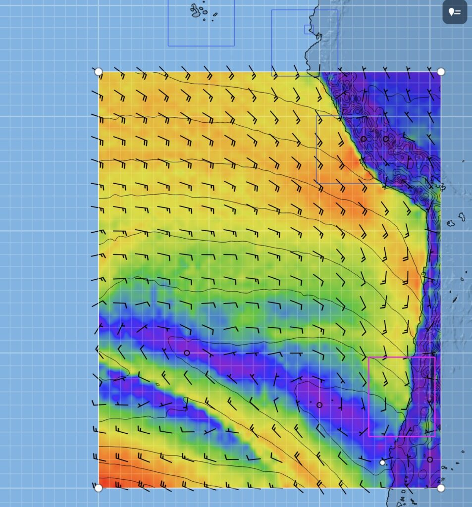
I thought that once I crossed 20 degrees south latitude and got into the trade wind zone the winds would become more steady and reliable. So far that hasn’t been the case. For the last several days the wind direction has varied over 50 to 60 degrees and the wind speed range from 7 knots to 25 knots. The forecast doesn’t reveal any of this. I hope as I move farther west and north the winds will steady.
Fortunately, the autopilot on my boat has a mode where you set it to maintain a given angle to the wind instead of maintaining a fixed course. As the wind direction changes, the boat heading will change so the wind is hitting the sails at the same angle and the sails stay full. The boat’s course will also change accordingly but out in the open ocean that’s not a big deal as long as the boat, on average, is going in the right general direction.
I also expected to pick up a following current, the Peru current, but that hasn’t happened yet either. The boat speed through the water has almost always been greater than the speed over ground (SOG), indicating a contrary current. The SOG is determined by GPS position fixes so it’s very accurate. The boat speed is determined by a little paddlewheel spinning on the bottom of the boat, much less accurate. Often the paddlewheel will get fouled with bits of weed or other things in the water that inhibit it spinning freely so it usually reports boat speeds that are too low. Unusual for it to be too high. If the paddlewheel calibration is off I can adjust it but I need a measured course in pretty still water, or run the course in both directions, to calibrate it. Not going to happen at sea. For now I’ll live with it. The SOG is the one that matters since that tells me how fast I’m getting to my destination.
Looking at longer range weather patterns along my route it appears the El Nino weather pattern may result in changing my destination from Gambier to the Marquesas. I won’t know for a few weeks yet but right now it looks like difficult weather and contrary winds going south to Gambier (at 23 degrees south latitude) while the Marquesas remain in the middle of the trade wind flow I’m now joining. The Marquesas are somewhat farther than Gambier but closer in terms of time if these wind patterns hold. I might have first heard of the Marquesas in Stephen Stills song “Southern Cross”. Great song.
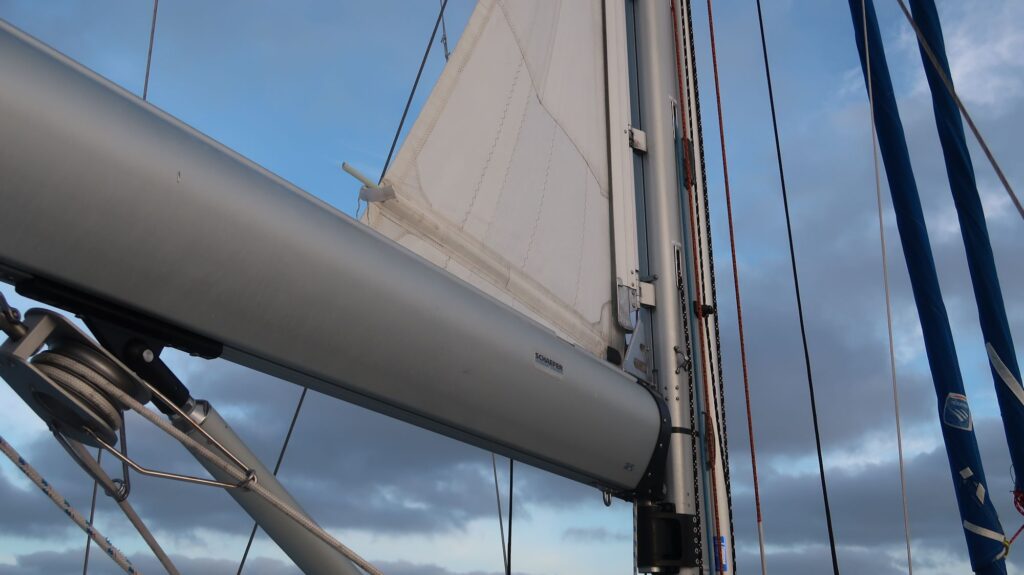
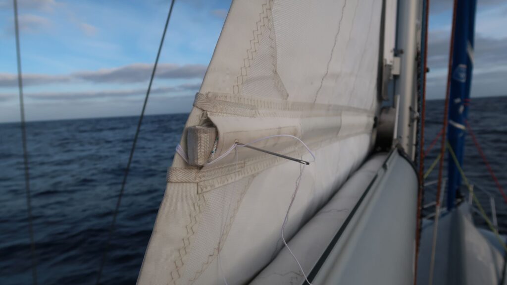
I’ve had one failure since leaving Puerto Montt, the top fiberglass batten in the mainsail broke. I have spare batten material which I inserted in the batten pocket but it needed to be cut to the right length with a hacksaw. This can be a little tricky if you do it while in place, holding the batten with one hand with the saw in the other hand and holding on to the boat with my third hand. My Dad, who is was in the Navy in WWII, said sailors have a rule “one hand for yourself, one hand for the ship”. What if the ship needs two hands? If you’re in the Navy you get another guy. Not an option on Phywave. It would be less convenient, but safer, to mark the batten length, pull it out, and take it back to the cockpit to cut it.
With the batten cut to length the next step is to push a strap attached to the sail into the batten pocket. The strap has Velcro on one side and wraps around the end of the batten where it’s then shoved deep into the batten pocket where the opposite Velcro is located. Usually this system is sufficient to hold the batten in place but on this voyage I’ve had problems with the battens working their way loose so I now sew them in. To do this I get my cordless drill and drill a hole through the batten pocket, the fiberglass batten, and sailcloth on the other side and sew the batten in with heavy sailmaker’s thread.
Otherwise, all is well on Phywave. It’s just a matter of turning the miles, day after day, week after week.
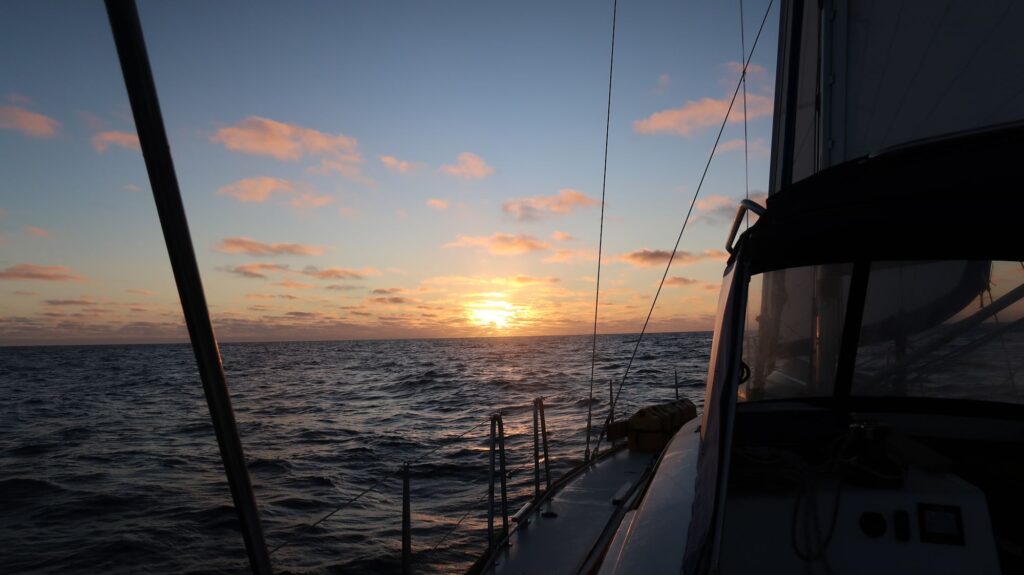
Busy OceanReplacement batten ready to be cut to lengthSewing the batten to the sailI never get tired of sunsets
I‘m finally underway again, sailing north along the coast of Chile toward the southeast trade winds, a westward flowing river of wind, that will take me across the Pacific toward French Polynesia. I should pick up those winds somewhere around 15-20 degrees south latitude, sometimes farther south.
I’ve changed my intended destination from that shown on my route planning map. I’m going to skip Rapa Nui (Easter Island) since I already spent a week there in 2013 visiting the Moai and other interesting archeological sites. The anchorages there are also renowned for being problematic with no real protected coves or harbors so a boat is exposed to the open sea and rolling swells most of the time. Changing wind directions move from one side of the island to another so that it’s best to move the boat very few days to stay on the lee side.
I’m also skipping Pitcairn Island group (4 islands). Though I’ve never been there it has the same issue with an anchorage that’s open to the sea.
Finally, I’m late getting going on this leg so to get pick up time I’m reducing stops and now sailing to the Gambier Atoll in French Polynesia. The anchorages of this archipelago are in the lagoon inside the outer reef forming the atoll. As the 16th century mariners discovered, it’s a bad idea to sail there directly from southern Chile and risk getting becalmed in the high pressure region that usually dominates that part of the South Pacific. The better strategy is to sail north along the coast of Chile to pick up the trade winds, so named because the early sailing ships followed them to trade with Asia. It’s the long way around, though, so I’m estimating around 4200-4400 nm to Gambier, a passage of 35-40 days, my longest by far. Once in the trade winds it should be pretty smooth downwind sailing with consistent 15-20 knot winds on the stern. One caveat to that is the current climate transition from La Nina to El Nino. In El Nino years the southeast trade winds tend to be weaker and more variable than in La Nina years.
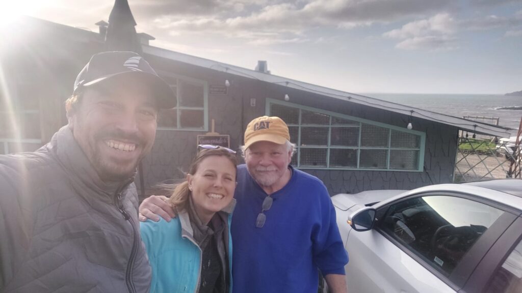
My stay at the Reloncavi marina stretched from my original estimate of 4 weeks to 6.5 weeks. The repairs to my mainsail took longer than expected followed by a week of bad weather offshore I didn’t want to bash into. Even though I wasn’t making progress on my voyage I was comfortable there with a rental car. I also got spend time with some good friends, Curtis and Kate, who I met in Puerto Williams. They are sailing Sweet Ruca, funding their travels with a great YouTube channel called “Sailing Sweet Ruca” with more than 110 episodes so far. They put a lot of time into producing high quality videos of their adventures. They even interviewed me for an upcoming episode because my mission to sail solo to 7 continents is unique and I’m in the same “demographic” as many of their viewers. On one of our excursions we took the ferry across to Chiloe Island for the day just to have a look around and stop for a seafood lunch at a restaurant overlooking the sea near Ancud. Sweet Ruca also will be heading across the Pacific to French Polynesia but not leaving Puerto Montt until August. I may see them again somewhere down the line, not unusual in the cruising community to once again encountered a boat and crew you first met years before.
I’m happy to say my work on the boat, especially cleaning and redoing the antifouling paint, paid good dividends. Motoring at 1750 rpm I now get a boat speed of nearly 6 knots. When I left the boat in Puerto Williams I was getting around 4.5 knots at that power setting. I also think replacing the zinc on the hub of the prop helped. Its cone shape would definitely assist smooth water flow around the prop, improving its efficiency.
I left Reloncavi marina on Thursday morning at first light, around 1200z. The route to the ocean winds around islands through various channels where many floating aquatic farms are found. I’m not sure if they’re for fish or shellfish – mussels, oysters and clams a popular around here. However, they are not lit, or marked on the nautical charts, so unless you’re a local and know where they are it’s treacherous to navigate these channels at night.
I stopped for an overnight anchorage at Puerto Abtao, about 30 nm west of Puerto Montt, to wait for the ebb tide passing through the Chacao Channel. The flood and ebb currents through the channel can be fast, up to 9 nine knots a times, so it’s essential to pass through westward on the ebb tide. Motoring through the channel on Friday evening I enjoyed a speed boost from the ebb current of over 6 knots, a total speed over ground (SOG) of more than 12 knots. Once through the channel I had to work my way west and north around a tight little low pressure system that popped up. Winds around low pressure systems blow clockwise in the Southern Hemisphere.
Now it’s just a matter of sailing north for the next few days and getting into the trade winds as soon as possible. At least the weather has been better than Puerto Montt where it was rainy, cold and windy much of the time, maybe one nice day per week. It is winter here. I’ve been sailing under mostly clear skies so far, a welcome change I hope continues. I was up early today to adjust sails. The stars and moon are brilliant against the deep darkness of the open ocean at night, my old friend the constellation Orion hanging upside down over the eastern horizon waiting for the coming orange glow hints of an emerging dawn. I think it’s going to be a good day.
Route so far as of Monday afternoonSE Trade Winds setup in a few daysSailing north along the coast of ChileWith Curtis and Kate
Upon arriving at the Club Nautico Reloncavi marina in Puerto Montt the first task was to get the three large cases down the gangway to the floating docks (muelles) and unpack them. Fortunately, everything seemed to have survived the long flight from Seattle.
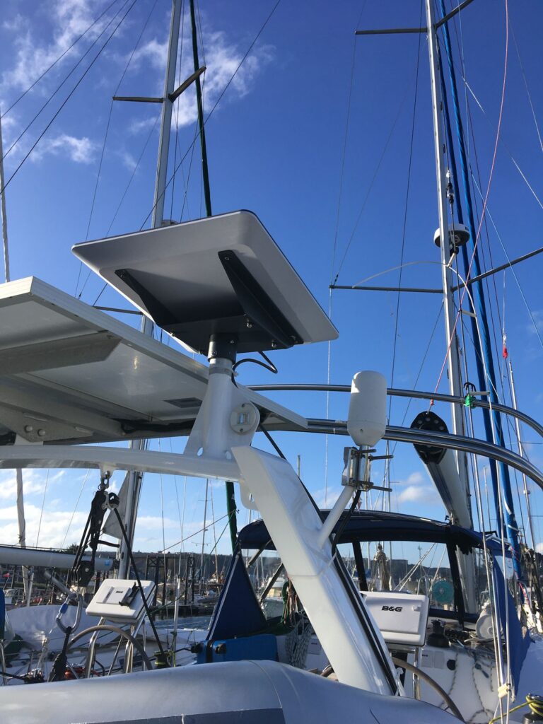
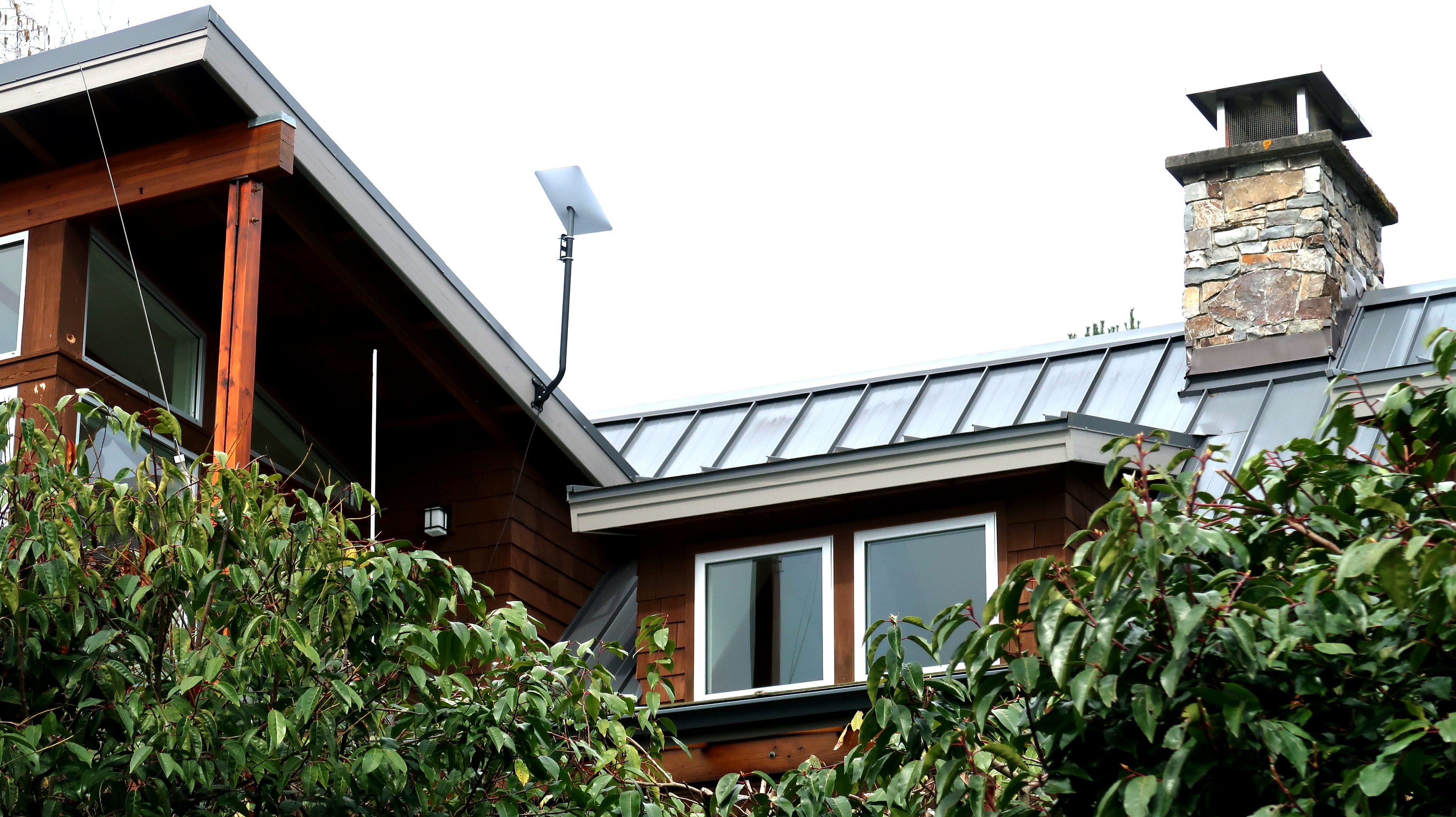
I was most curious to see how well the Starlink dish would work so in the first few days after arriving and spend my time getting the dish mounted on the arch, running the cable through a new hole I drilled in the deck (with waterproof gasket fitting) and mounting the power supply, router, and small 12 VDC to 120 VAC inverter to the power Starlink components. I connected the inverter to a 30 Amp circuit breaker I had already installed for the Icom HF radio.
The dish itself was mounted to a post welded onto the stern arch next to the solar panels. A Starlink-available pipe mount I brought with me slid perfectly over this post. The mount is normally intended to be held in place by set screws. I don’t rely on set screws to hold anything – they too easily work loose – so I drilled a hole through the mount and the pipe and through-bolted it using a long stainless bolt and locknut I brought with me from home.
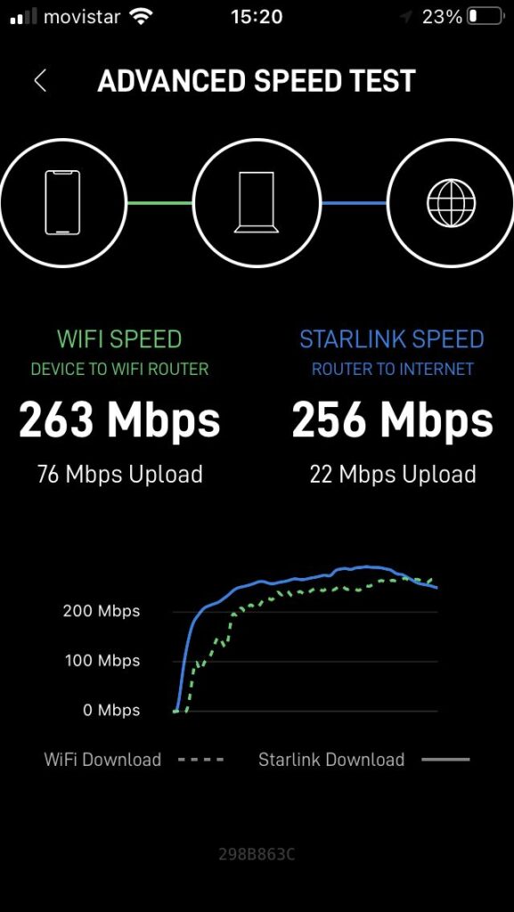
The installation fired right up with download speeds greater than 200 Mbps. I’m very pleased with it. I’ll probably keep my Iridium GO account active for a while as a backup until I see exactly how reliable Starlink will be at sea.
Starlink HP flat dish mounted on the arch
First speed test with Starlink
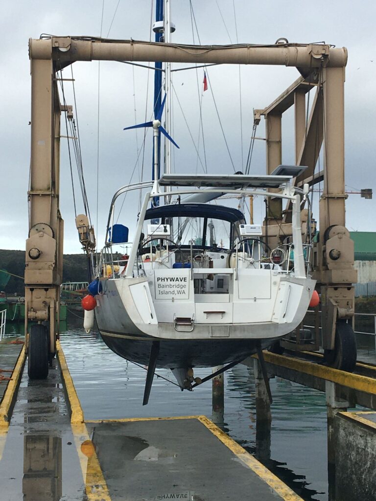
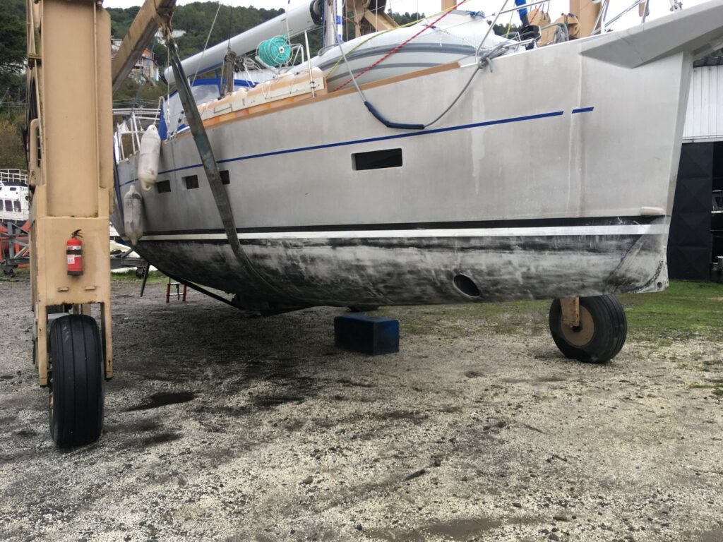
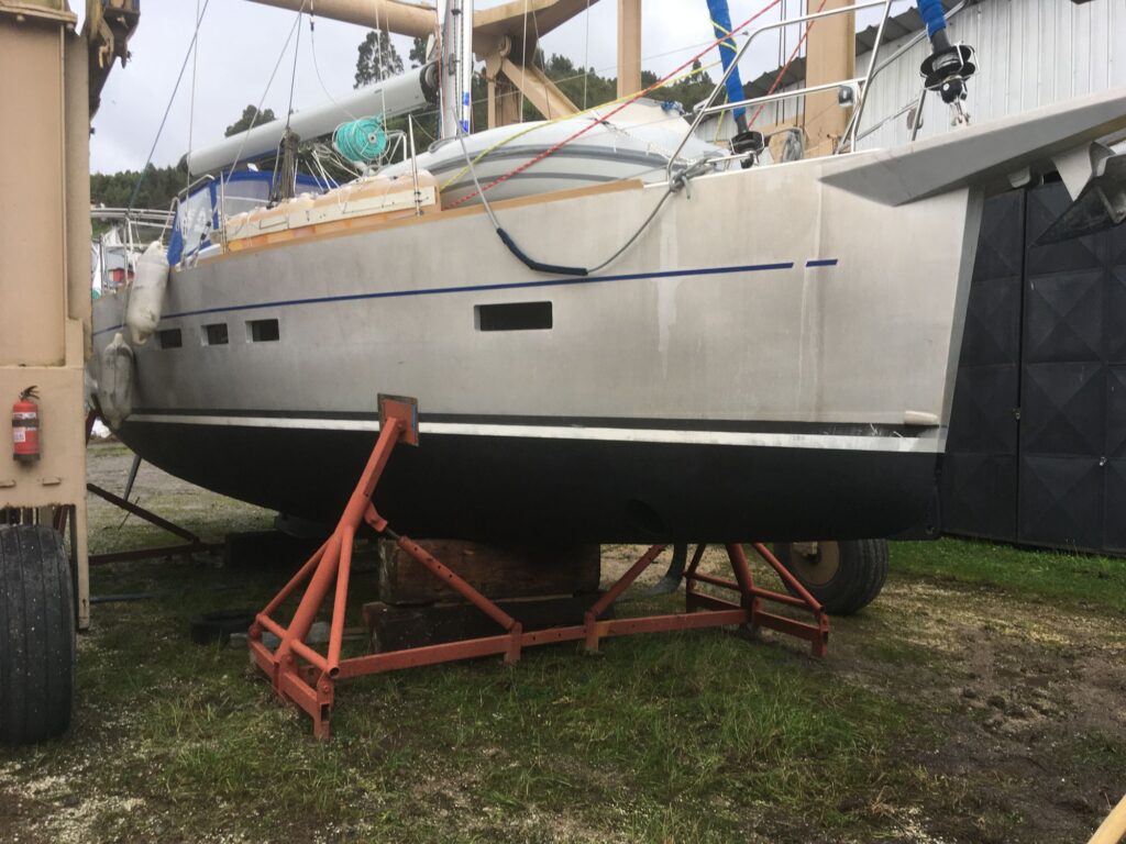
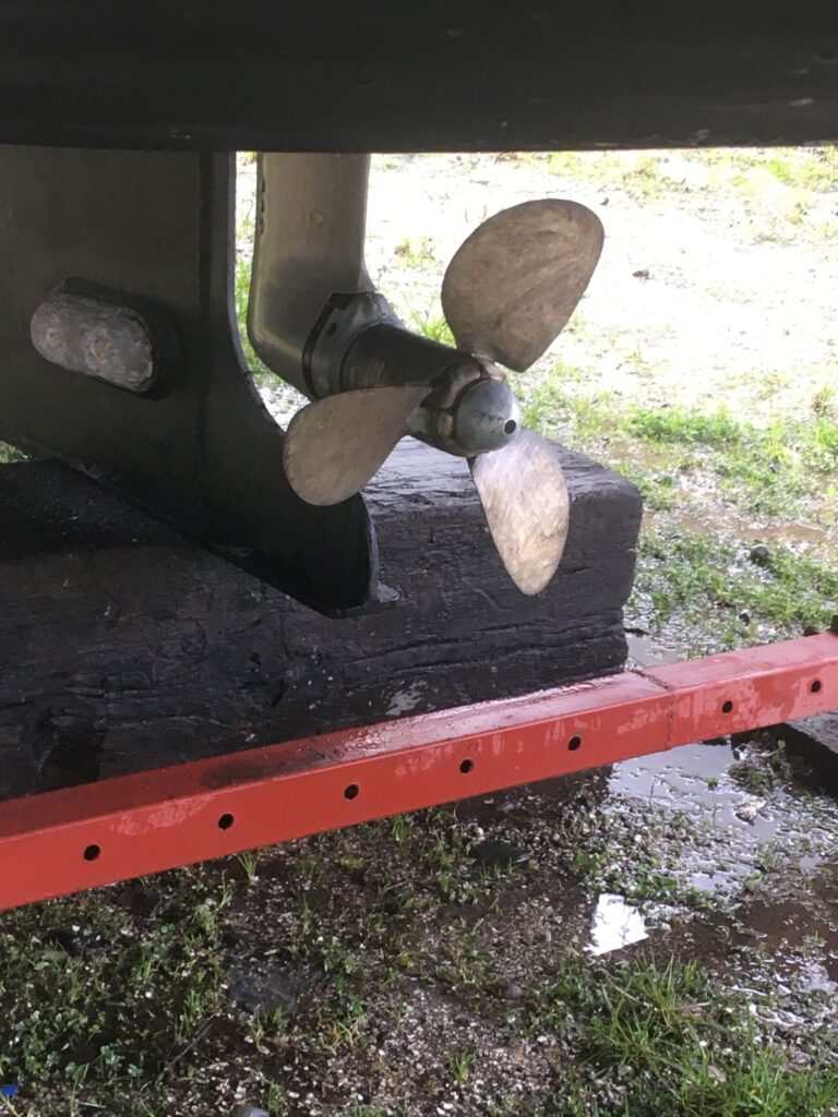
Next on the list was hauling the boat out of the water and putting it on a stand on land (called “on the hard”) so new new anti-fouling paint could be applied. When it came out of the water I was surprised at the fairly poor condition of the paint. The boat had only been in the water for a little over a year. I was even more surprised that the zinc anode on the hub of the prop was completely gone. The zinc anode is meant to be slowly eaten away by the natural electrolysis process that occur when a boat is in salt water. The zinc will get eaten away first before corrosion can start on other metal fittings like the prop or thru-hulls. Normally the zincs would be replaced when they are about 50% gone. On close examination there was no corrosion on prop, and the hull zincs were still in good shape. I replaced the prop zinc with a spare I have but I’ll have to keep a closer eye on it in the future and replace it sooner if needed. It really should not have disappeared completely in a year.
Lifting Phywave out of the waterThe travel lift moving Phywave to its stand
After the old anti-fouling paint on the hull was sanded, 2 coats of anti-fouling paint went on. There were rain showers off and on but the painters got some lucky breaks with dry weather.
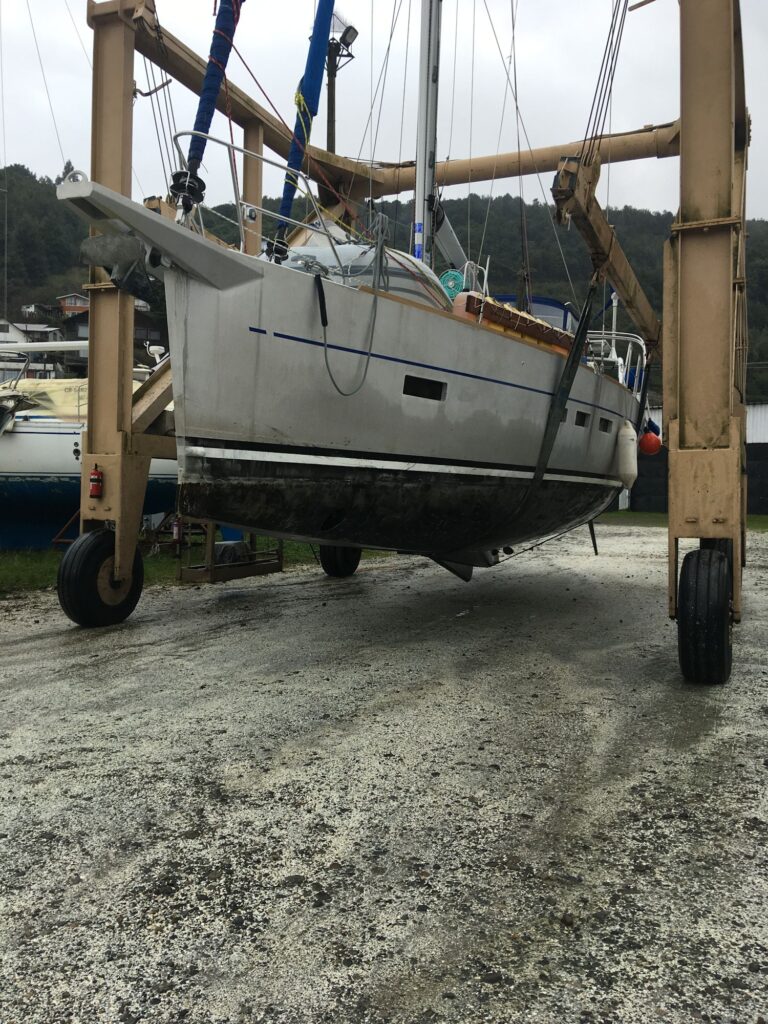
Phywave after the old anti-fouling paint on the hull was sanded
After about 6 days out of the water the travel lift came back, picked up the boat, and dropped it in the water where I drove it back to the same place on the dock where it was before. The two travel lifts they have at Reloncavi are small compared to others I’ve seen so I had to disconnect both backstays allowing the lift to drive close enough to the center of the boat to pick it up. I’m never comfortable with the backstays off, especially with some strong winds blowing across the marina, but there is still plenty of tension holding the mast up from the shrouds and forestays. Still, not ideal; I was happy to reconnect the backstays once the boat was back at the dock.
Phywave with new anti-fouling paint
It’s pretty uncomfortable to stay on a boat when it’s on the hard, especially if there’s no place to plug in to get power. A ladder is also needed to get from the ground to the deck – I have a telescoping ladder on board. Instead of staying on the boat, I booked a cabana at Tungulu Cabanas very near the marina up on the hill overlooking the Tenglo Channel – a fantastic view to the south. It was a very pleasant respite that spoiled me, I think. Life on the boat is a downgrade by comparison.
New zinc anode added to the hub of the prop
There is still a lot to do. Changing the engine oil and filter come next, and the paper filters in the Racor primary diesel fuel filters. I also need to sort out the many jugs (bidones) of diesel left on board, a few just partially full, five of which were added after I left the boat in Puerto Williams. Some of that fuel looks dirty with small bits of what looks like rust at the bottom. I’m not sure where Mauro got this diesel but I’m inclined to discard some of it. Of course, I have a separate funnel filter I use to put diesel into the deck filler neck, a funnel filter I actually used to carry on my plane. Once I have the diesel sorted out I’ll fill up the main tank and then all the bidones I decide to keep which should give me a total fuel load on departure of about 850 liters. Since the next leg will be almost entirely sailing (hopefully I don’t get becalmed in the Pacific) that fuel load should be much more than needed, certainly more than most people would carry.
After the engine maintenance is completed I’ll turn to the running rigging and sails. I still haven’t raised the mainsail yet so I don’t know its exact condition but expect batten replacement and minor sewing repairs will be needed. The canvas bimini and connector panel to the dodger were also damaged by high winds sailing south in the Atlantic so they also need some patching and sewing work.
I look forward to all the maintenance work being completed so I can start sailing again.
When I left Puerto Williams on February 20, I was pretty burned out on sailing and living on the boat. The preceding 7 months had been intense sailing, for me at least, covering more than 12,000 nm, crossing the Atlantic Ocean twice, landing on 4 continents, culminating in a challenging solo voyage to Antarctica and back. I was due for a break.
I originally planned to be at home for 6 weeks, that timing meant to line up with meeting the delivery crew I hired to move my boat from Puerto Williams to Puerto Montt. In retrospect I realized 6 weeks was not long enough for a number of reasons.
There was a problem with the delivery crew I hired. That crew consisted of an older Australian sailor with extensive sailing experience in Tierra del Fuego and Antarctica as well as his home waters, that sailor’s adult son, also experienced in these areas, and the son’s girlfriend, sailing experience unknown. I thought this was a good choice. As it turned out they did a very poor job of planning the voyage. They booked outbound flights from Puerto Montt that left them only about 5 weeks to complete the trip. Similarly, they only brought about 4 weeks provisions with them. It was not nearly enough time or provisions given the highly variable and difficult weather that’s encountered along this route and would certainly delay them at times. I also think they viewed this as a family sailing holiday through Patagonia rather than a job commitment, taking a casual approach rather than pushing to get the delivery done as quickly as possible. After going only 80 miles in 2 days and getting pinned down by bad weather for about a week, they abandoned the voyage and returned to Puerto Williams with a variety of complaints (excuses). I encouraged them to refuel, re-provision, and change their outbound flights to provide more time but they chose to walk off the job instead. Given this sailor’s reputation I expected him to be trustworthy and complete the job I hired him for, and what he promised to do. Clearly it was a mistake to rely on him.
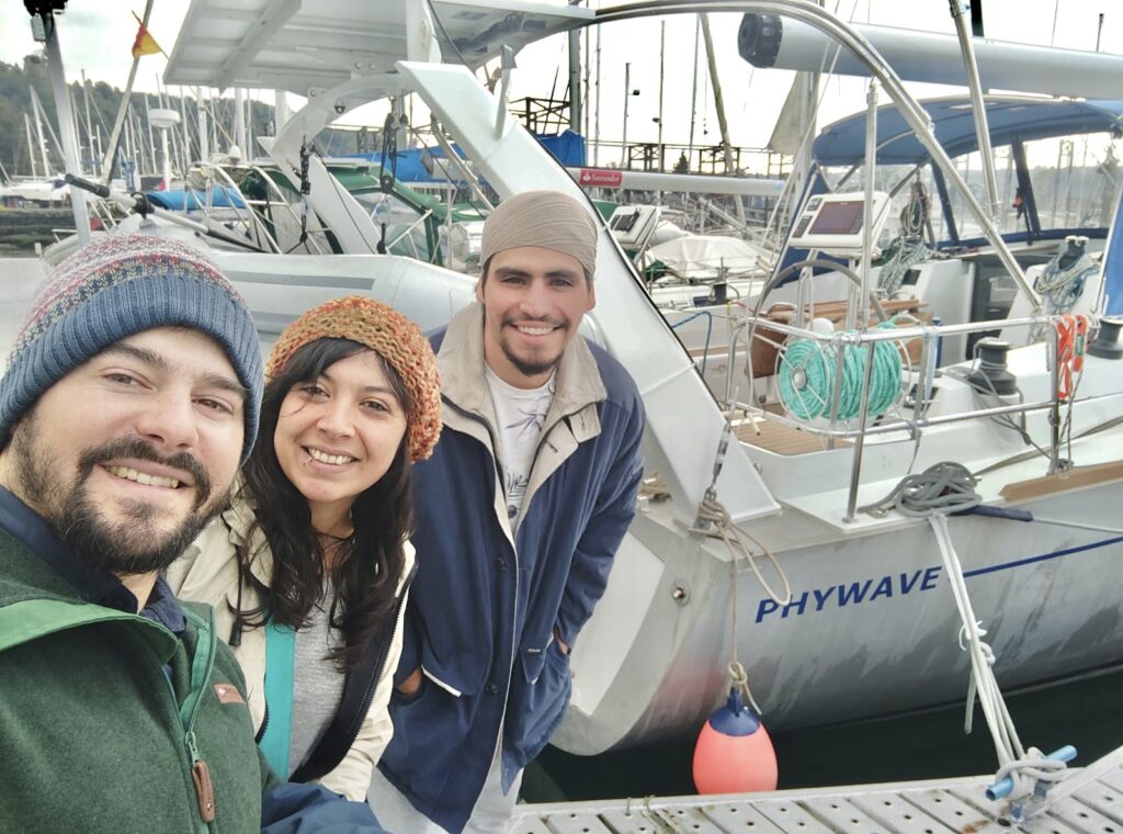
Fortunately, I was able to hire a replacement delivery crew within a few weeks. Mauro Carrizo is a Puerto Williams captain with his own sailboat Serendipia he uses for charter trips to the channels and fjords of Tierra del Fuego and south Patagonia. When I first arrived at Micalvi in Puerto Williams in January, Serendipia was the boat I tied alongside. Mauro’s family was on board at the time – his young daughter handed me an Oreo cookie across the railing. It was a nice welcome to Micalvi. Mauro gave me a fair, all-inclusive price for taking my boat to Puerto Montt along with 2 crew members he would hire. Mauro and his crew left Puerto Williams on April 15 and arrived in Puerto Montt on May 11, just 26 days to make the voyage and conclusively demonstrating there were no problems with my boat (which was among the Australian’s excuses). If you are thinking of taking a charter cruise in Tierra del Fuego or southern Patagonia on a sailboat I can highly recommend Mauro. His website is
Mauro, on the left, and his crew with Phywave in Puerto Montt.
Having to hire a replacement crew delayed my schedule about 6 weeks but it was an additional 6 weeks I needed at home. It really took that long for me to feel re-energized about getting back to the boat and sailing across the Pacific. It also opened up an opportunity that I hadn’t expected.
When I left Phywave I had a long list of gear I needed to bring back to the boat. As I described in my previous post, while at home I decided to add a Starlink dish to that list. I have friends on 2 boats now sailing north in Patagonia that are using Starlink with great success so it made sense to add it. There are many other boaters around the world also using Starlink. It offers the ability to have a fast, open internet connection while sailing the Pacific unlike the Iridium Go which I now have. The Iridium Go is pathetically slow (less than 2 kbps speed) and uses a restrictive Iridium internet portal that only supports a very limited number of apps. It’s really impractical to use for anything more than text emails and downloading compressed weather forecast files called GRIBs.
I originally bought Starlink’s Standard dish which is designed for home or portable use. It’s not really intended for use on boats. After that purchase Starlink made some major changes. While I was at home they significantly lower the price of hardware and airtime plans for their Maritime package. The Maritime package consist of a larger dish (bigger aperture = narrower radiation beam, more gain, lower sidelobes and wider pointing angle range; i.e., a better antenna). It’s also designed to be mounted flat and pointed straight up making in more rugged than the Standard dish which is on a motorized pole mount and not meant to be used in motion. With the big price reduction I decided to return the Standard dish for a full refund and buy the Maritime package. I have a good place to mount it on Phywave’s arch. The only real downside is that it draws 2-3 time more power than the standard dish – always an important consideration on a modern sailboat that relies on electrical power and battery storage for just about everything from navigation to radios to the autopilot. Inconveniently, all Starlink dishes are powered by 120 vac which means I need to use an inverter to power it from the 12 volt batteries on the boat. Of course, the boat is already equipped with a large inverter but I rarely turn it on. I didn’t want to use it just to run Starlink so instead I bought a small sine wave inverter to run Starlink. The small inverter has a convenient on-off switch to eliminate the power drain when I’m not using Starlink. I’ve yet to install it all but I hope it works out as planned. Others have gone a step further and used various components to power Starlink directly from the 12 vdc on the boat, bypassing the 120 vac power supply. Making that conversion involved more work than I wanted to do.
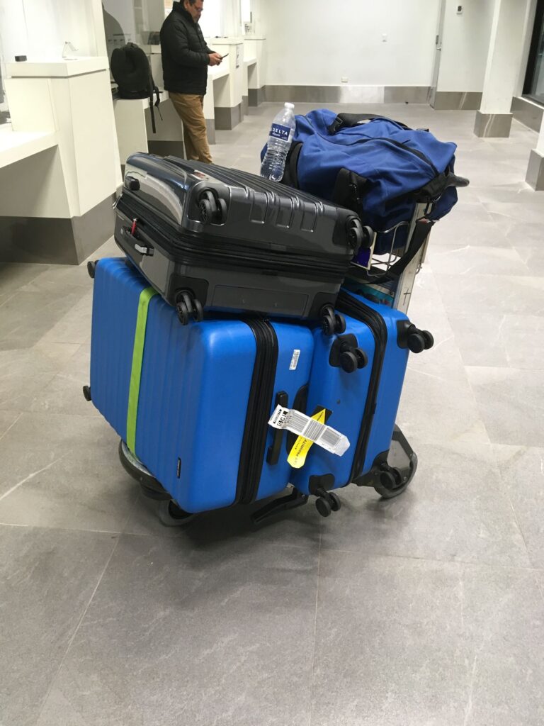
With the Starlink Maritime dish and its components, and the other gear I already planned to bring back to Phywave, I had 3 big suitcases I needed to get to Chile as checked luggage. I shuffle things from one to another until they all weighed about 50 lbs. Fortunately, I was flying on Delta to Santiago, in the Delta One cabin, so 2 of the bags flew for free and the third cost me $200, still vastly cheaper and simpler than trying to ship them to Chile. Even so, for someone who has flown commercially, and in my own plane, all over the world for years with nothing more than a single carry-on duffel bag, all this luggage felt like a hassle to move around.
Upon arrival in Santiago I was directed to the Customs inspection line where my very poor Spanish served me well. After some back and forth and using Google Translate with the Customs agent, who became visibly frustrated at trying to understand the purpose of what was in my cases (para mi velero a Puerto Montt!), she waved me through.
My pile of luggage after arriving in Santiago and clearing Customs.
Rather than try to get all the gear on the local flight and small plane to Puerto Montt, no doubt with high excess luggage charges if they’d take the bags at all, I decided to rent a car and drive to Puerto Montt. It was the right move. The big cases fit easily in the car. It was an pleasant 2 day drive south with an overnight stop in Chillan. I found very pretty countryside along the way, first through vineyards followed by farms and managed forests in the hills farther south. Having flown over this part of Chile in my own plane 3 times, it was a pleasure to see it from the ground.
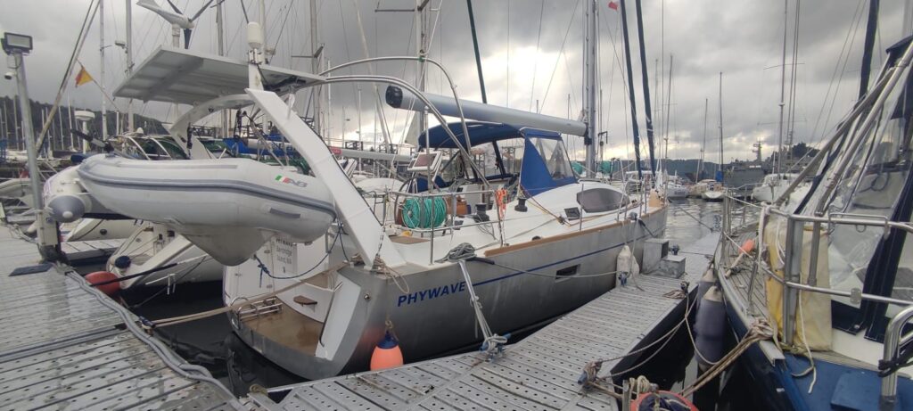
I am finally back at Phywave and the cases are unloaded (not sure what to do with the empty cases). I’ll be here at least another 3-4 weeks getting various maintenance items done, including new anti-fouling bottom paint, and of course, installing Starlink. I’m in the marina at Club Nautico Reloncavi, a really nice marina compared to what I’ve experienced recently. I look forward to getting Phywave ready for the next chapter in this solo voyage to 7 continents.
Phywave at Club Nautico Reloncavi marina, Puerto Montt.
I have friends on yachts who are using Starlink dishes with great success in Patagonia, Brazil and other parts of South America. So I decided to buy one and temporarily set it up at home to see how well it worked.
I bought the Starlink Global ROAM package. The dish itself is just 12” x 20” and easy to set up. The hardware cost about US$700 but the “best effort” global service plan is US$200/month. “Best effort” means “you get what you get” in terms of speed. At times I get greater than 100 Mb download speed, more typically 30 – 50 Mb. Not super fast but certainly adequate and still vastly better than the Iridium GO I now have on board. I wouldn’t want it for a permanent installation at home since I have an optical fiber connection here providing as much data speed as I’m willing to pay for. The ROAM service plan is a month-to-month plan so I can stop and restart the service (and monthly cost) to suit how I intend to use it.
My plan is to take this Starlink back to the boat, assuming I can get it through Chilean Customs without too much drama. There are a number of videos on YouTube of people removing or disabling the motors in their dishes and mounting them horizontal on the top of RV’s, vans and boats (planes?). Apparently the Starlink satellite constellation is now dense enough that this works about as well as the motor-steered dish and obviously would be mechanically much simpler with less wind resistance. I’m considering doing this but am hesitant because it involves cutting the plastic shell and resealing it into a new horizontal mount of some kind. Given it’s going to be on a boat with big waves (I’ve had waves break over the whole boat, flooding the deck and cockpit), having it be water tight is an important criteria. Some ad hoc mounting work will be required at the boatyard in Puerto Montt where my boat is now headed.
There is also the issue of using it offshore since the service plan says land only. There supposedly is a geofence so the thing won’t work when you get about 12 nm or so offshore, or so they say. However, I’ve heard reports of people using Starlink while crossing the Pacific on yachts so it remains to be seen if the geofence really kills service offshore.
I flew out of Puerto Williams on Monday, February 20, and arrived at my home on Bainbridge Island, WA, on February 22. It happens to be colder here right now than it was in Antarctica! I’m not sure how long I will be home but several weeks for sure. I have a list of things to bring back to the boat and a tall stack of mail to go through. Being that time of year, I have tax returns to prepare and file (I’ve done my own for many years), and a few other time-sensitive things that need attention.
The next leg of my voyage is from Puerto Williams north through the canals and fjords of Patagonia to Puerto Montt which will be my departure point for crossing the Pacific. The scenery along this route is apparently spectacular – I remember flying over part of it when I flew my plane a couple of times between Puerto Montt and Punta Arenas. In my initial naivete about the area and the sailing conditions I assumed I could sail this solo with many anchorages along the way. Having now spent a fair amount of time in Puerto Williams and discussing it with very seasoned sailors in this region I came to the conclusion that doing this trip solo was an unwise thing to do. Although people have done it solo, the experienced sailors I talked to wouldn’t try it solo themselves. There are many narrow anchorages where shorelines are needed to secure the boat. Setting shorelines solo is a challenge, something I’ve done before, but in settled weather with no real wind to push the boat out of position once I leave it in the dinghy to connect one or two lines to the shore to stabilize the boat’s position.
The weather conditions along this route are also particularly unfavorable this time of year with very volatile, gusty, wet weather and mostly headwinds so very little sailing and about 90% motoring. I’ve expressed before how I dislike running the engine.
Taking all these factors into account, I decided I’m not going to try to do this solo. With that decision made, I further decided to hire a crew to take Phywave to Puerto Montt, a crew with many years of experience doing Antarctica charters and sailing the waters of Tierra del Fuego and Patagonia. They will take Phywave to Puerto Montt while I am home for a break. That crew is scheduled to come to Puerto Williams soon to pick up Phywave in Puerto Williams.
This decision means I won’t be able to claim sailing around the world solo because I will miss crossing a few degrees of longitude (roughly between 67.62 degrees and 72.93 degrees west) which I can perhaps cross at the end my voyage by sailing across the Caribbean to Panama en route to the Pacific Northwest. That part of my voyage is a long ways off so many things could affect it in the meantime. As with flying, sailing around the world means crossing all the longitude lines (meridians), and for some, crossing the equator twice.
Of course, my real objective as expressed on this website is sailing solo to 7 continents. Having a crew take the boat along an inshore route from Puerto Williams and Puerto Montt in South America doesn’t compromise that goal. I have now sailed solo to 4 continents with 3 to go – Australia, Asia, and North America. I left from North America so I can’t yet count that one until I’ve sailed there from someplace else. There’s nothing official about any of this so I’m pretty much deciding myself what it means to sail solo to 7 continents. It’s a great adventure regardless of how it’s described.
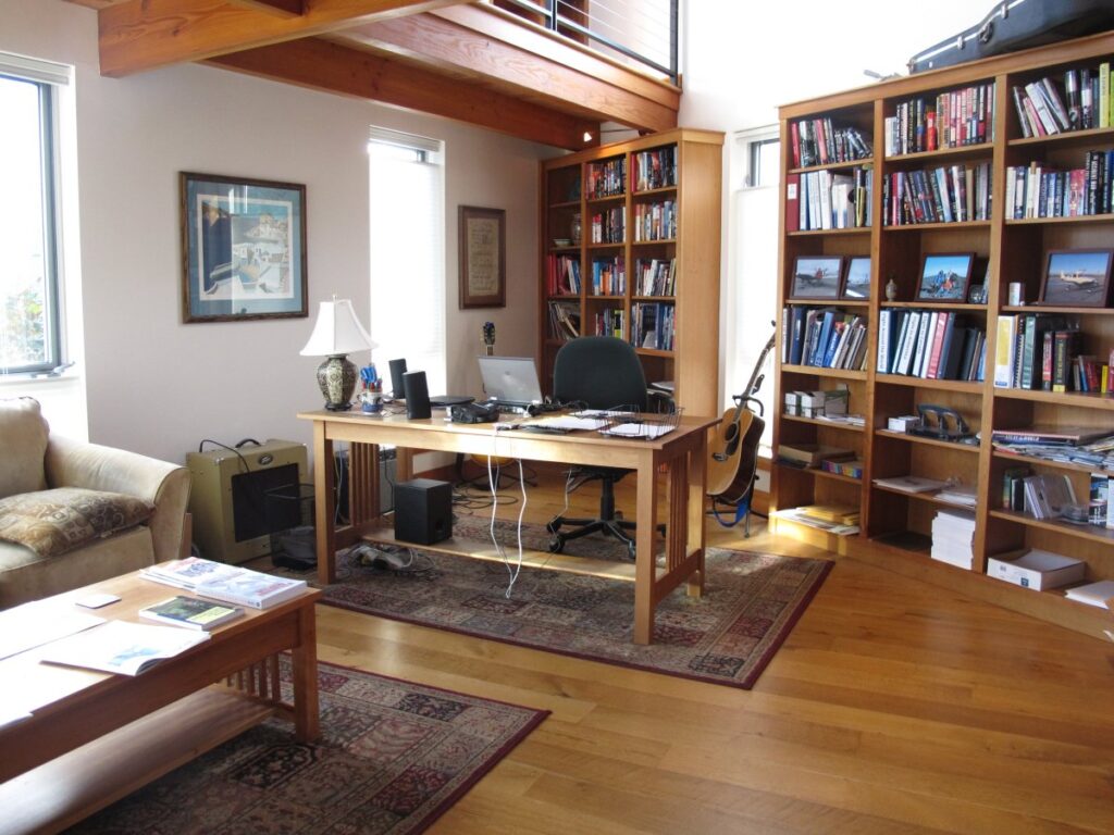
My Bainbridge Island home My two level office/library. There’s more floor area in this one room than my boat. Of course, with a deck and the interior cabin the boat also has two levels – and it floats. This room doesn’t float.
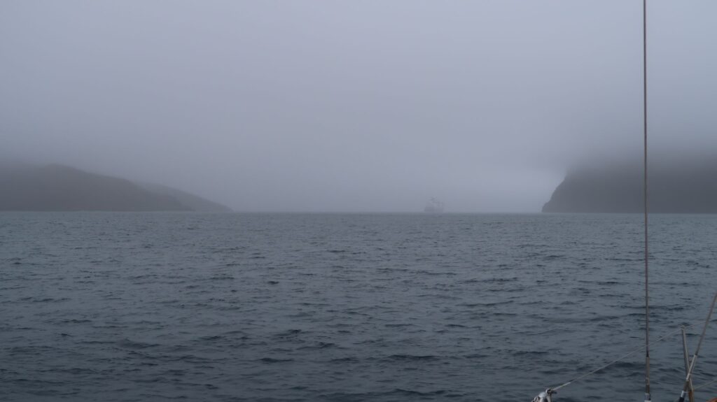
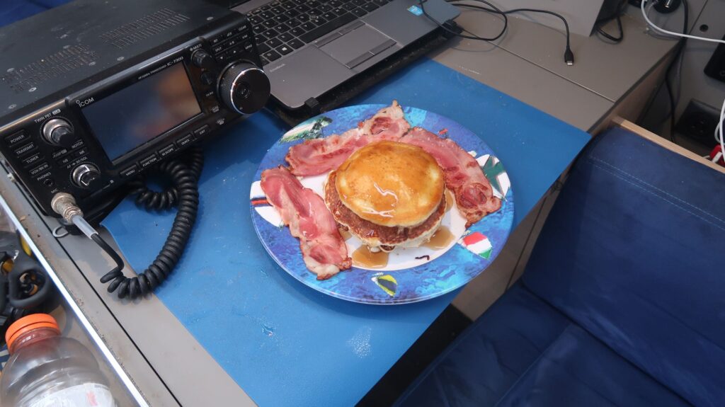
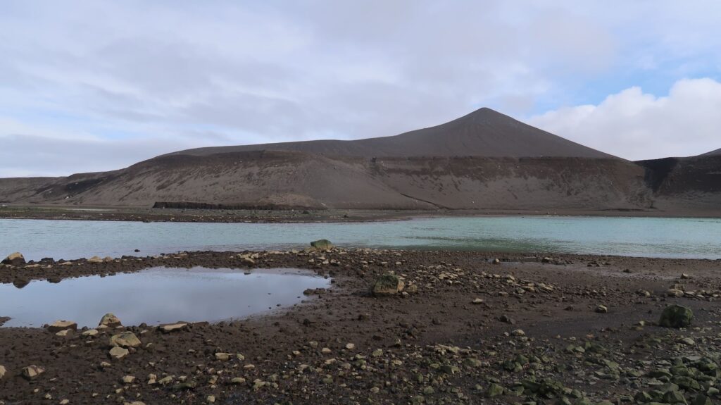
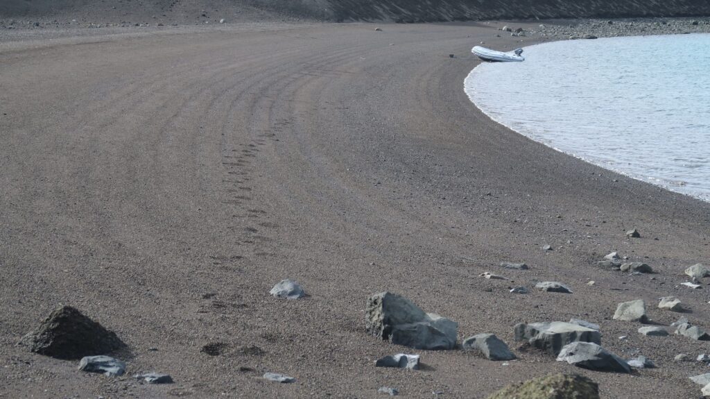
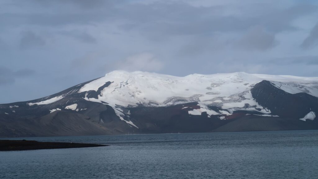
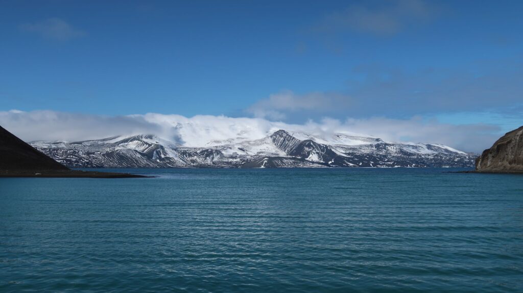
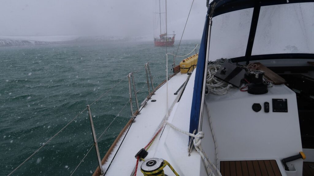
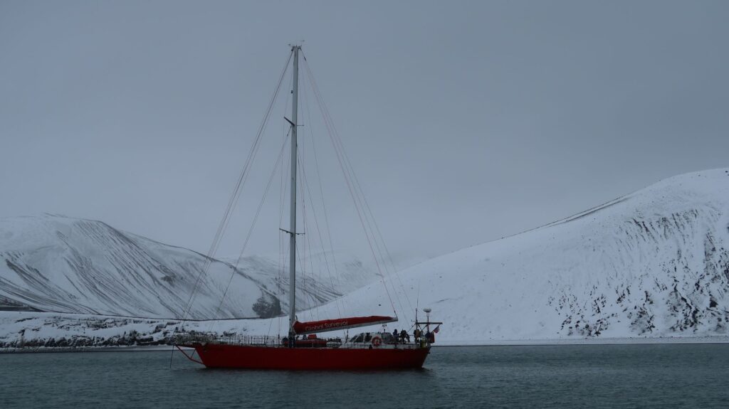
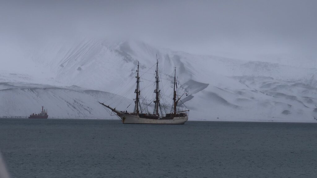
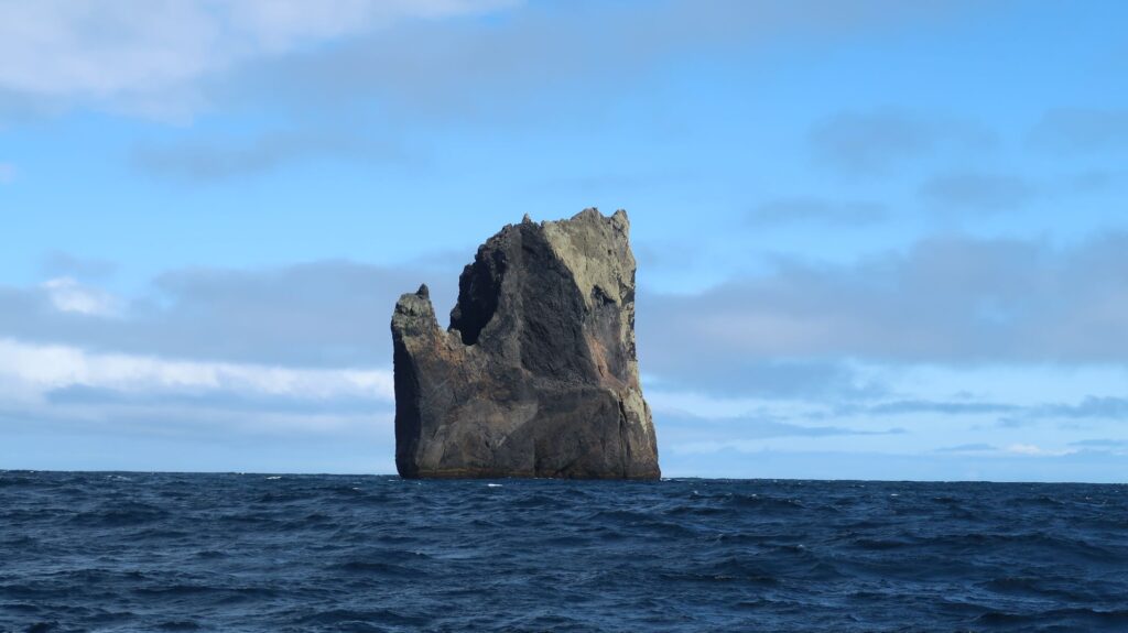
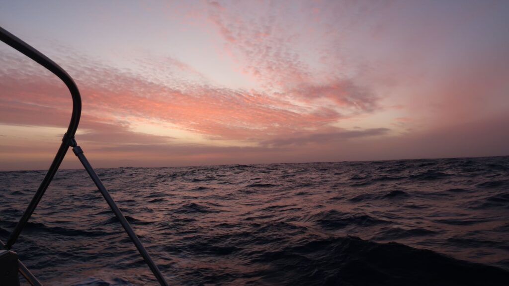
Ship in the fog passing through Neptune’s Bellows, Deception Island.Celebration breakfast – pancakes and bacon. I never make pancakes at sea.Footprint on the beachBlizzardSailing ship EuropaNew Rock west of Deception IslandSunset departing Antarctica northbound
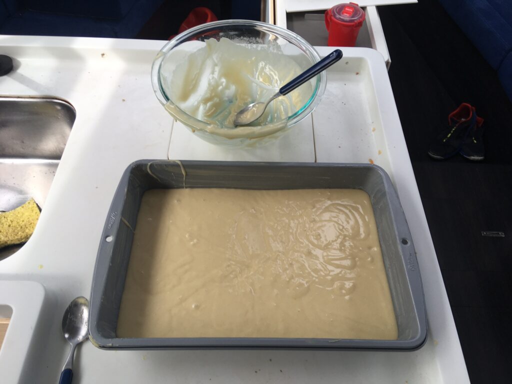
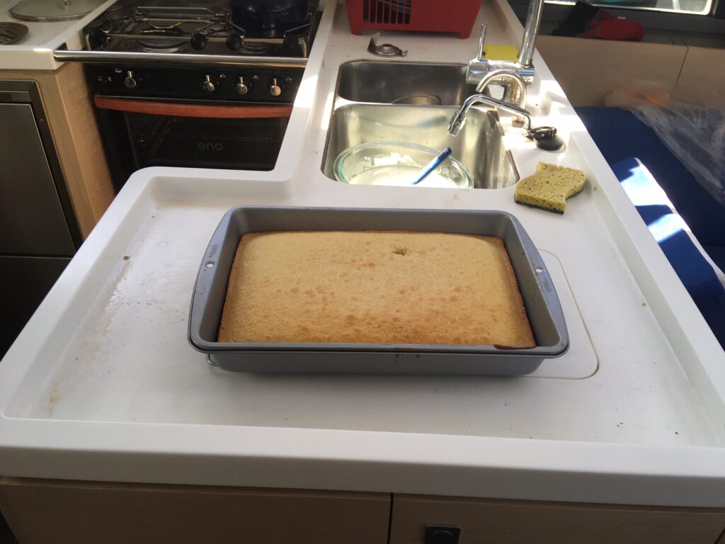
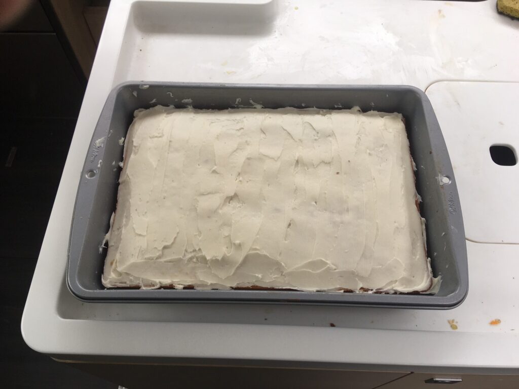
To celebrate my successful but difficult solo voyage to Antarctica, I baked this cake in the little gas oven on the boat. I plan to invite the boat neighbors I’ve gotten to know to come over and share it.
Out of the bowl and into the panOut of the oven and coolingFinished cake.