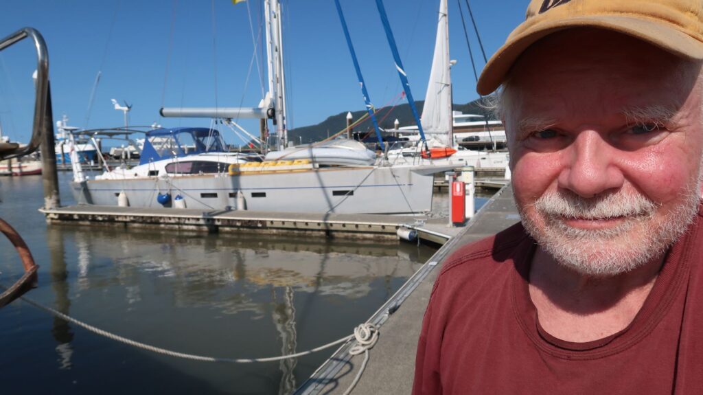
Hot and sunny, squinting eyes selfie. I finished entry formalities so I can now leave the boat and enjoy the many nearby restaurants. I’ll push on to Darwin in 3 or 4 days. Clearing-In here gives me more flexibility on my route north and through the Great Barrier Reef.
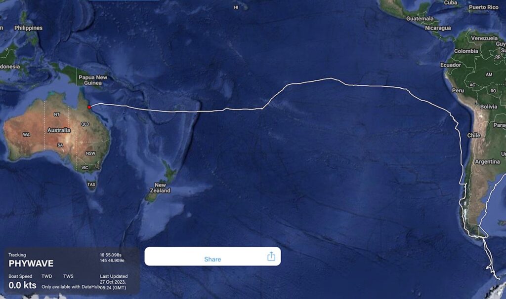
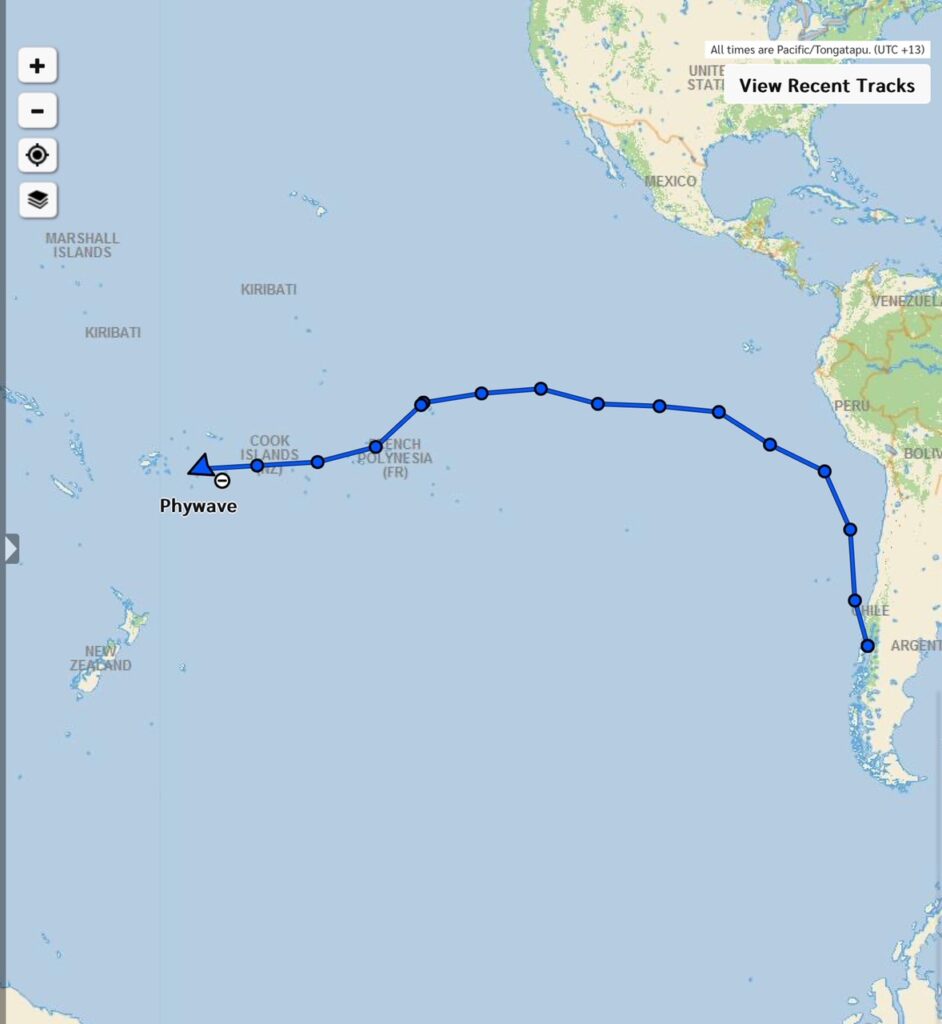
In the Marlin Marina in CairnsRoute across the Pacific
I can download a number of weather forecast maps based on different forecast models but the two I mainly use are the ECMWF model (known as the European model) and the GFS model (known as the American model). I’ve tended to rely on the European model because it can offer somewhat higher resolution and seems to have been a little more accurate when comparing the forecast conditions to the conditions I’m actually experiencing. All the model forecasts tend to converge as you get closer to a forecast day and time, as you might expect.
The ECMWF and GFS models provide forecast out to 10 days. I usually want to see that so I have as much notice as possible on what to expect and can make adjustments to my sailing plan as early as possible. When I was flying my plane around the world I didn’t need such long term warnings. My flight legs were typically only 5-6 hours long so I was just looking for suitable weather windows to keep moving forward. Otherwise, the plane is safe on the ground if bad weather arrives.
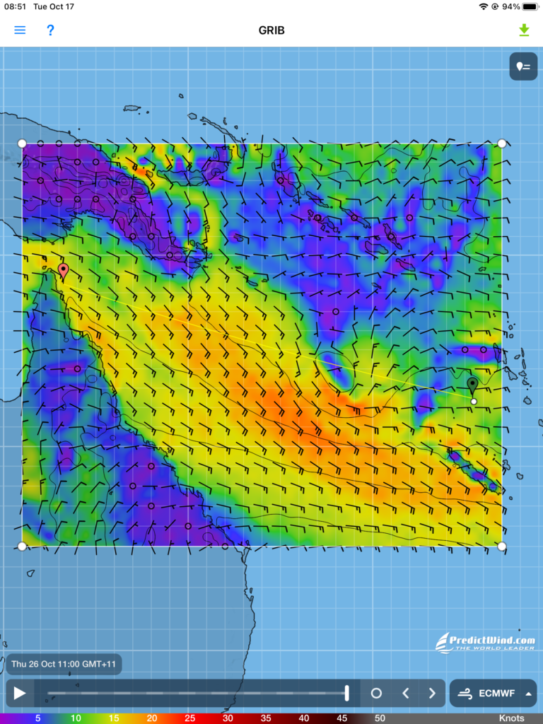
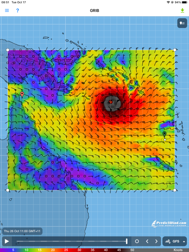
As I start out westward across the Coral Sea I’ve looked at the forecasts from the ECMWF and GFS models 10 days out , as shown in these screen captures. The GFS model shows a typhoon moving south westward over the Solomon Islands while the ECMWF model shows a benign low pressure system in the same place. The websites that specifically track South Pacific tropical cyclones (typhoons) have no alerts about tropical depressions or waves that could develop into cyclones.
What to believe? If the typhoon is real, it is moving westward toward the Torres Strait where I plan to be about the same time. That’s an untenable situation. So in case it’s real I need an alternate plan. That alternate plan is to now steer for a point just north of a tiny island/reef called Sand Cay, a course slightly south of the course directly to Torres Strait. From the Sand Cay waypoint I would be only about 200 nm from Cairns, Australia. That’s about 1.5 days in the boat so if I need to run for shelter that will be my plan. If no storm develops I can just turn north and head for Torres Strait, and of course alter my course at any time if it becomes clear no storm will develop.
There is also the option to heave-to and just drift around south of the storm track, then resume my course to Torres Strait once it has passed.
I will eagerly download each new set of forecasts as they’re produced every 12 hours to see what’s happening. A typhoon this early (October) would be very rare. The tropical storm season here officially runs from November to April with most cyclones occuring from December to March.
Planning for contigencies like this days in advance is an element of sailing the oceans that I didn’t experience when flying across the oceans. Let’s hope the GFS-forecast typhoon never materializes.
ECMWF forecast 10 days out. The white dot on the right is my current positionGFS forecast 10 days out showing tropical cyclone.
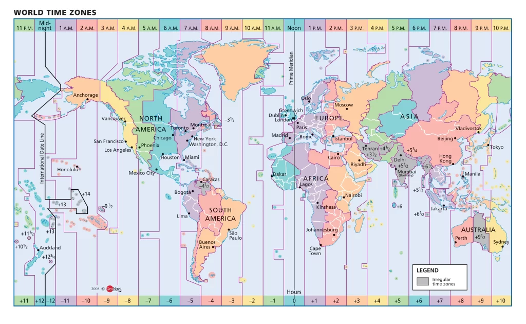
If you think crossing 180 degrees west longitude is crossing the international dateline you’d pretty much be wrong. The international dateline is a politically-hatched snake that slithers its way north-south across the Pacific Ocean. For example, in Tonga (officially, the “Kingdom of Tonga”) local time is GMT+13. The higher math I know says that’s the same thing as GMT-12. Yes, but Tonga has very close ties to New Zealand. In fact, the shop and restaurant owners I got to know in Neiafu complained they couldn’t find local workers because they all went to New Zealand to pick fruit! Tonga wants to be on the same day as New Zealand so they invented GMT+13.
Then you have places that aren’t satisfied with being an even hour difference from GMT. They have half hour (Marquesas) or even quarter hour differences. There can be no rational explanation for this except sheer bloody mindedness.
When I was hitchhiking around Africa in 1975 with backpack and guitar I got to know Swahili time in Kenya, on the equator. Zero o’clock was when the sun rose, consistently at about the same time. I remember bus schedules written in chalk on blackboards listing departures in Swahili time, which itself was an optimistic fiction because a bus rarely left until it was full of people, luggage, livestock, etc. It would drive all over town scooping up willing passengers to fill it.
On the boat I keep clocks and the log in GMT, except my watch which is set for my best guess at a local time. The weather forecasts are all in GMT so I need to convert to a local time to understand if the bad weather is going to hit me in the middle of the day or the middle of the night. Otherwise, it doesn’t matter much what time it is. The sun comes up then goes down, called daytime, the rest being nighttime which is routinely forecast to be dark. Then there’s the morning you wake up and realize it’s been tomorrow since yesterday.
I never flew on the supersonic Concorde but I’m told you could take off from Paris at 10 am and arrive in New York at 9 am. If you kept going around the world that way you’d never get old. We need to bring that back.
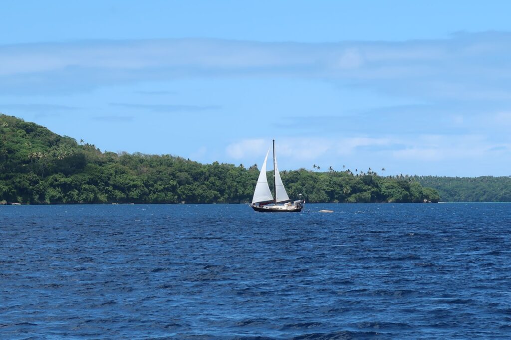
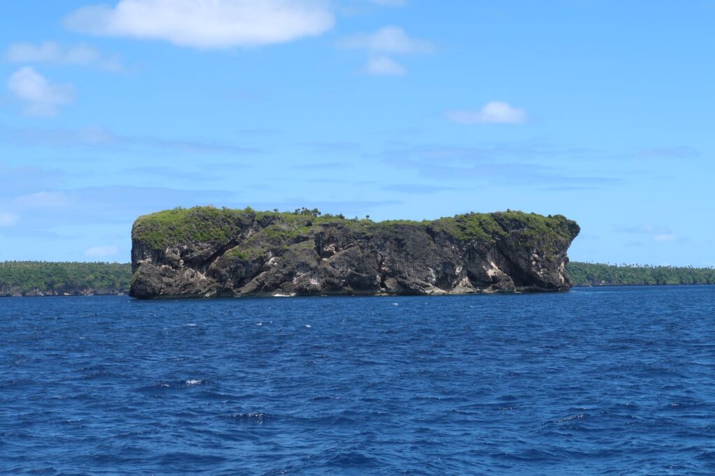
I’m including a few more photoss from Vava’u as I leave there and head due west toward Vanuatu, crossing 180 degrees west longitude into the Eastern Hemisphere for the first time in Phywave.
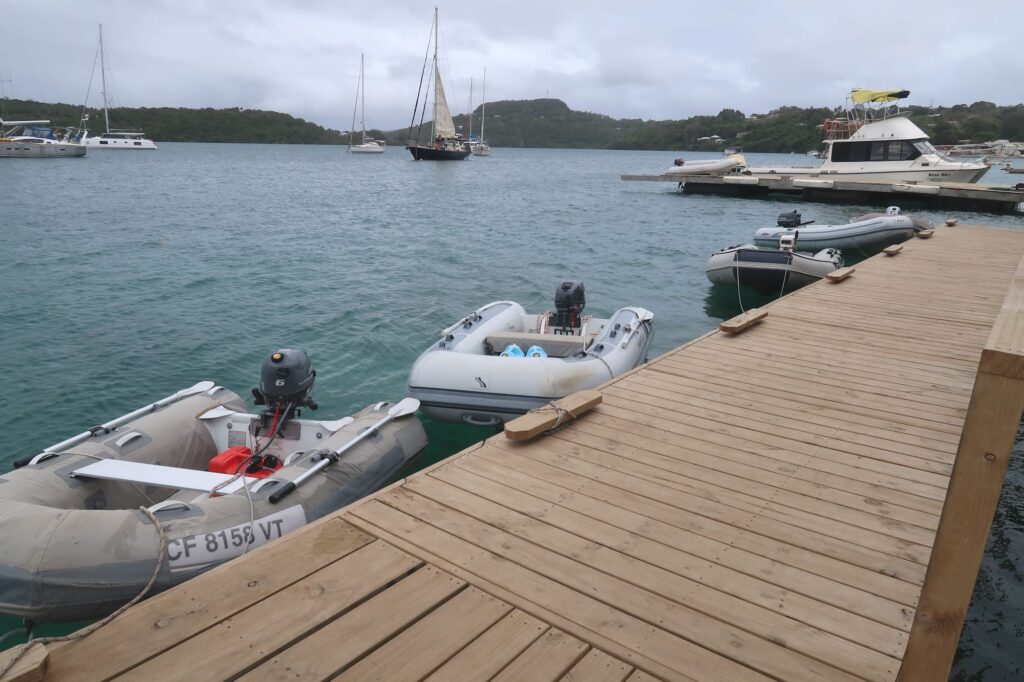
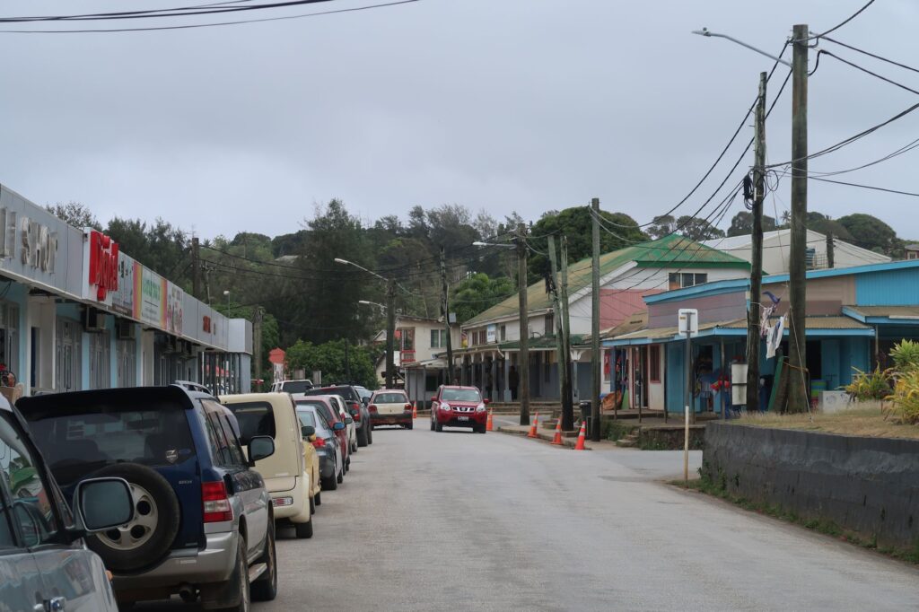
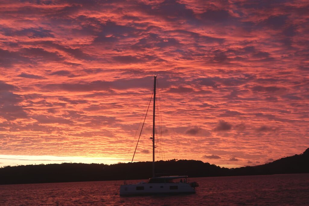
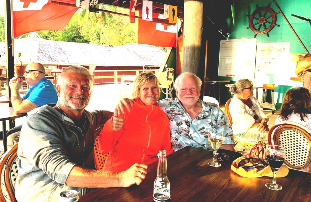
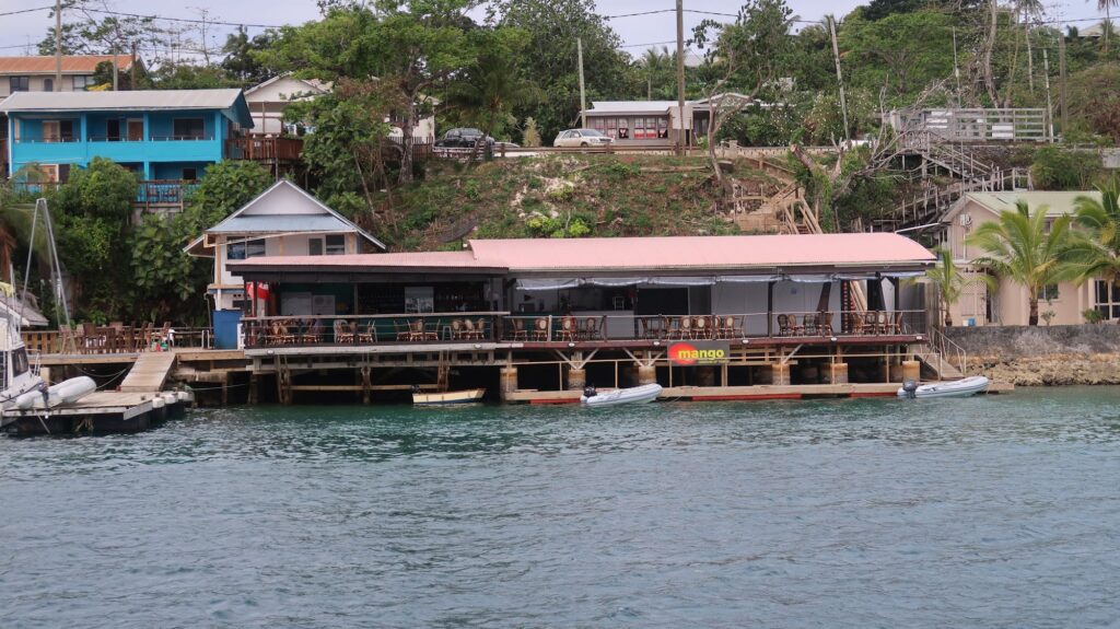
The dinghy dock at Mango Cafe with half of Phywave on the left edge of the photo in the distanceMain street in NeiafuA brilliant sunset from my mooring locationA yacht sailing to Neiafu as I was leavingOne of the many small islands in the Vava’u archipelagoWith my Swedish friends Lars and Susanne from s/y Sea Wind at the Mango Cafe
After an unplanned stop in Papeete for 10 days to have some essential repairs done on my mainsail, I had a fairly uneven crossing to Vava’u in Tonga – periods of no winds followed by 4.5 meter waves with 8 second intervals and 30-35 knot winds. To take a break from these conditions I heaved-to for a while and let the boat drift westward.
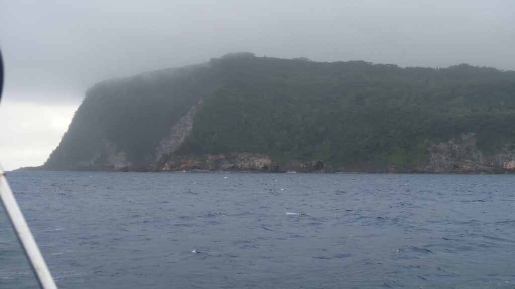
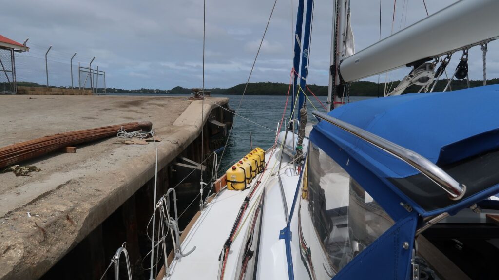
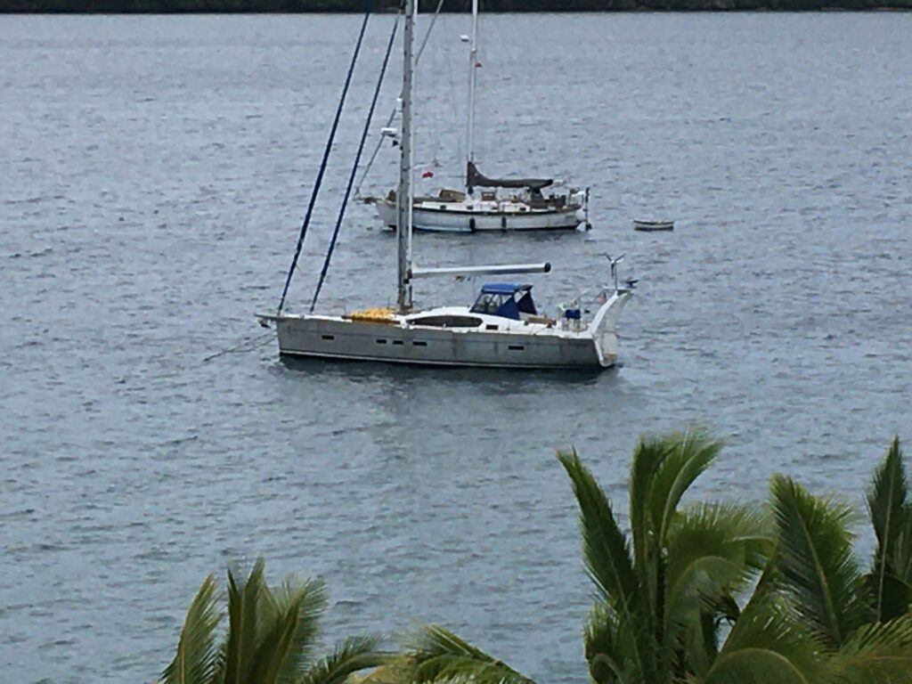
Wind and rain greeted me as I finally maneuvered through the outlying islands of the Vava’u group into the narrow channel that leads to the main town of Neiafu. After tying up to the commercial dock to spend a couple of hours going through the Customs and Immigration clearing-in process I was faced with finding a place to put my boat. Neiafu is located on Refuge Harbor, a well-protected but fairly deep harbor with abundant coral heads making anchoring there a tricky proposition.
To accommodate the many yachts that come here, a few companies have installed a number of moorings. Moorings are basically very heavy weights, like a big block of concrete, sitting on the bottom. The blocks are attached to heavy duty lines with loops that are pulled to the surface by a buoy or float of some kind. Attaching the mooring lines to the bow cleats on a boat provides very secure holding even in strong winds, assuming the mooring is in good condition (they need periodic maintenance).
I faced a couple of issues after clearing-in. I contacted the 2 companies by radio that have essentially all the moorings and both told me they were all taken because last week was the Vava’u Blue Water Festival and a lot of boats showed up to participate. The second problem is that it can be difficult to pick up the moorings lines when sailing solo, especially if it’s windy. I have to maneuver the boat as close as I can to the mooring buoy, then leave the helm and try to fish the mooring loops out of the water with a boat hook while the boat is now drifting way because no one is at the helm. Of course, after grabbing the mooring loop you have to be ready to quickly get it tied to something on your boat. Just trying to pull on it with your boat hook is good way to lose your boat hook. I have a clever hooking device I can put on the end of my boat hook with a line attached that solves that problem, but not the problem of the boat drifting away. I’ve always been able to grab a mooring with the boat hook eventually but it may take several passes with the boat to get it – a very frustrating process.
Fortunately, some long-time friends I had never actually met solved both problems. I’ve followed a Swedish couple, Lars and Suzanne Hellman, on their boat Sea Wind for more than 18 months after I first spotted them going to Antarctica in 2022 and wanted to keep track of where they anchored. Since then we’ve traded many emails and I’ve followed their posts on Facebook and YouTube. I knew they were already on a mooring in Neiafu so I sent them a quick email asking if there were any open moorings near them. Lars immediately came back and said he was headed in to town in his dinghy and would look around for open moorings on the way. 15 minutes later, as I was pulling away from the commercial wharf, Lars came along side in his dinghy and said he found a great mooring very close in to town that just opened up. He not only led me to it, but when we got there he fished the mooring loops out of the water and put them around my bow cleats. The boat was hooked up and secure! Lars and Suzanne are amazing, helpful people who assist many cruisers, organize events, etc.. I had them over to my boat that evening and opened a great bottle of red wine I bought in the Algarve I’d been saving for a special occasion. They had preceded me to Puerto Williams, Antarctica, and Puerto Montt so we knew a lot of the same people in these places and had many stories about similar experiences.
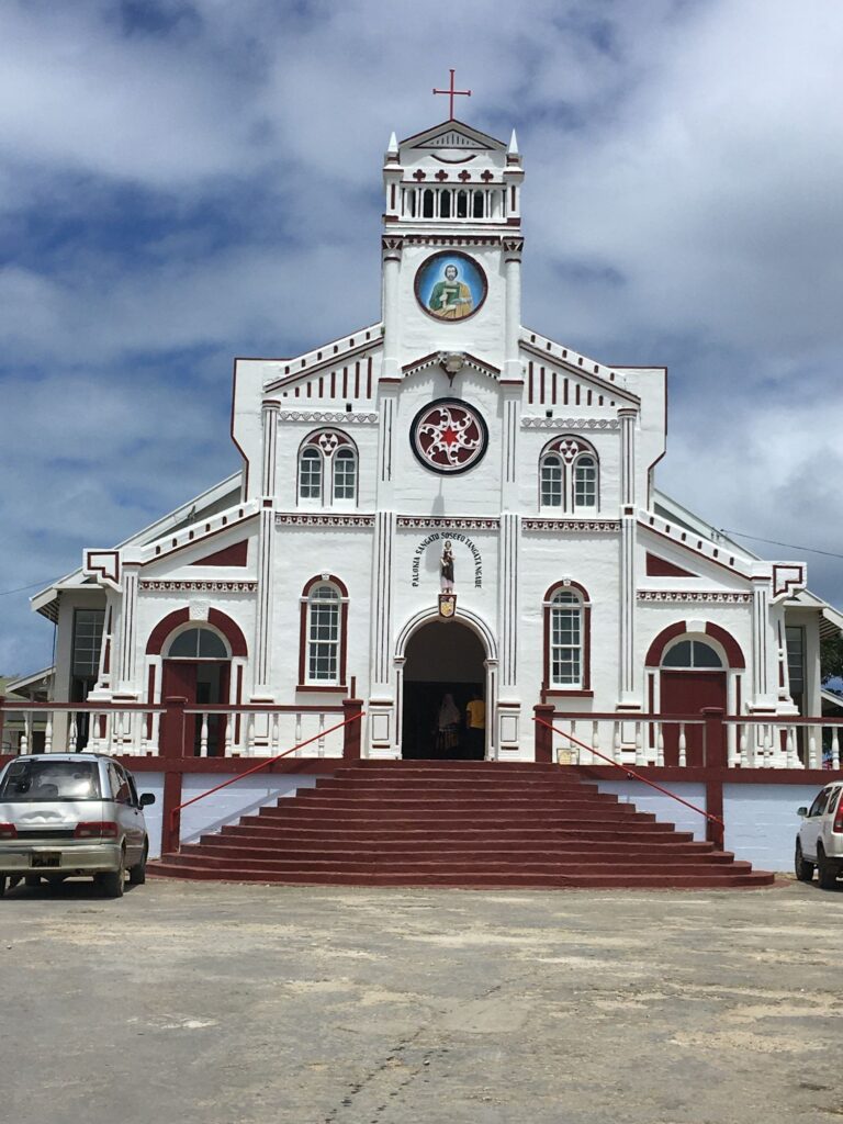
This morning, Sunday, October 1, I was relaxing in the boat’s cockpit with a cup of coffee when I heard music coming from the nearby Catholic Church. The beautiful voices of the choir had found their way across the water to me and Phywave, a wonderful start to a peaceful morning and my first full day in Tonga.
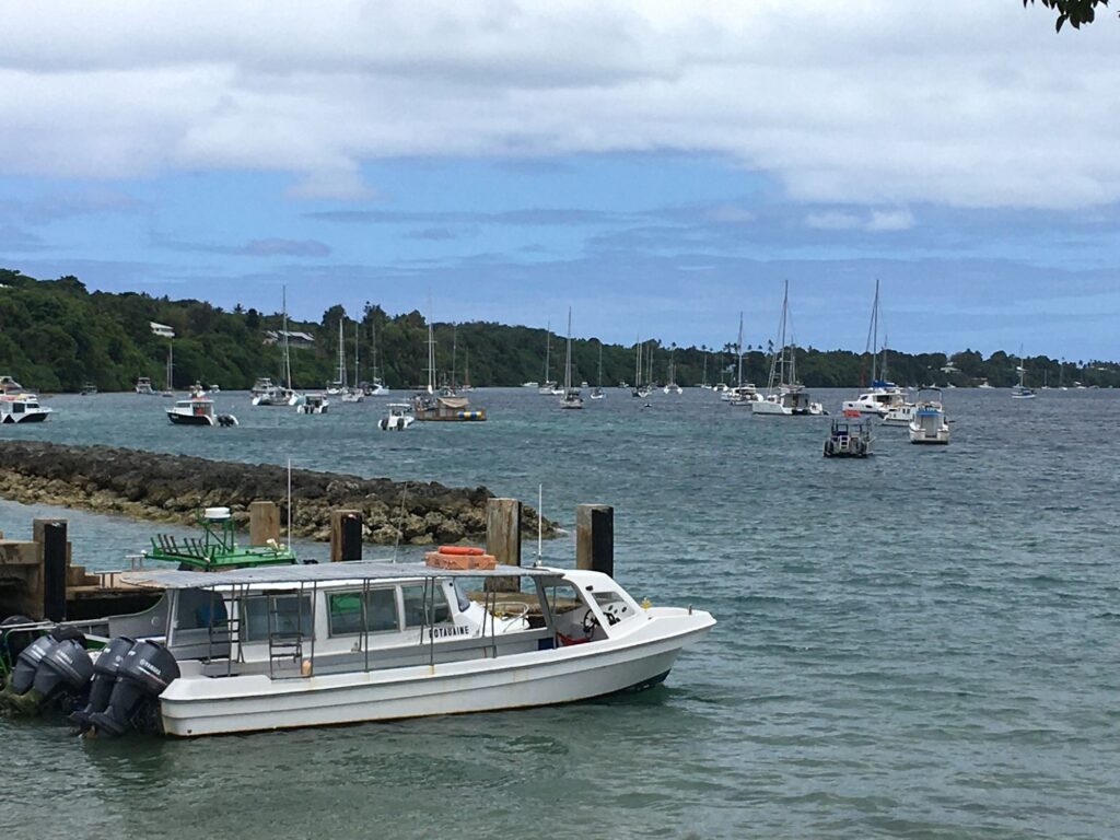
Vava’u headlands through the mist and rainPhywave tied to the commercial dock for clearing in.Mango Cafe with its dinghy dock from my mooring locationCatholic Church in NeiafuSmall boat harbor and mooring field filled with boats in the distancePhywave moored just offshore in front of the Mango CafeRoute across the Pacific from Puerto Montt to Tonga