Monthly Archives: November 2022

Cabedelo to Mar del Plata, Days 1-4

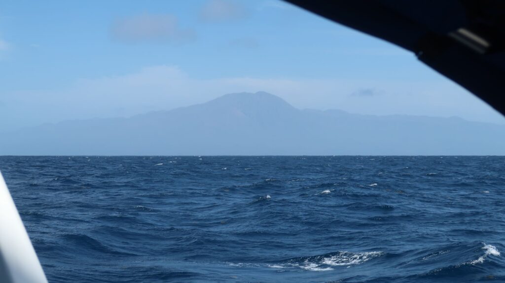
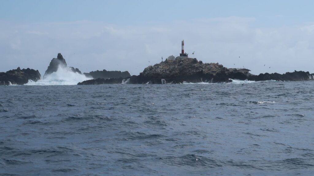
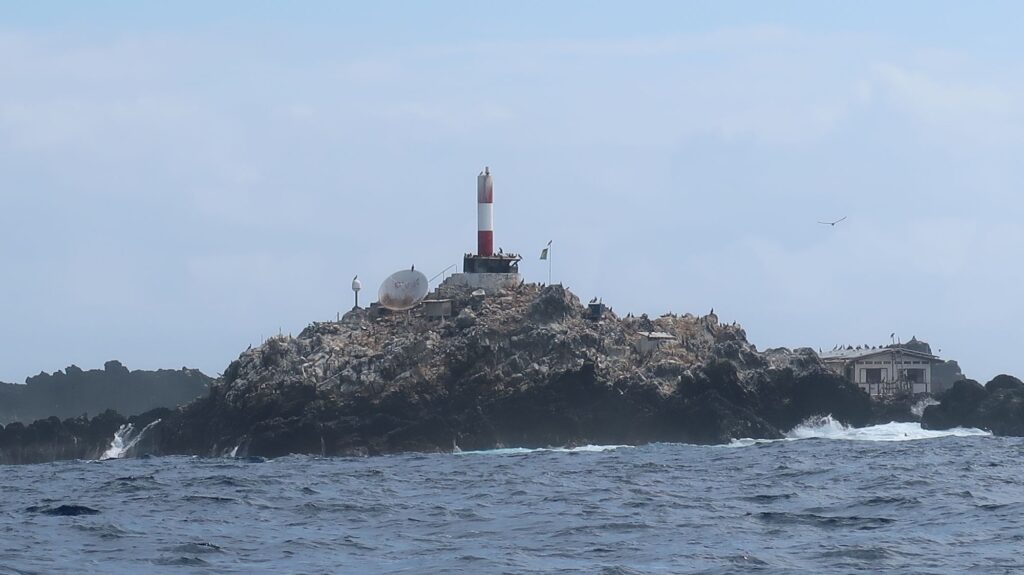
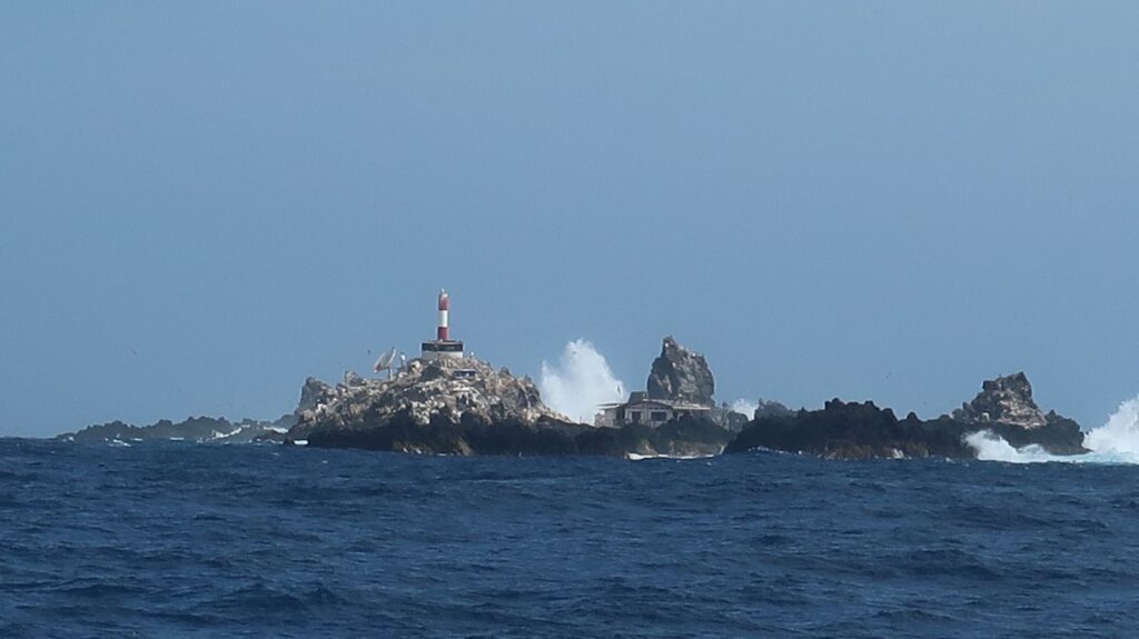
I left Marina Jacare Village on Tuesday morning, November 22, and made my way north along the Paraiba River for a few miles before turning seaward in the narrow, marked channel passing the north end of the pennisula where the town of Cabedelo is actually located. Slack tide had just passed so I was slowed by a building flood current.

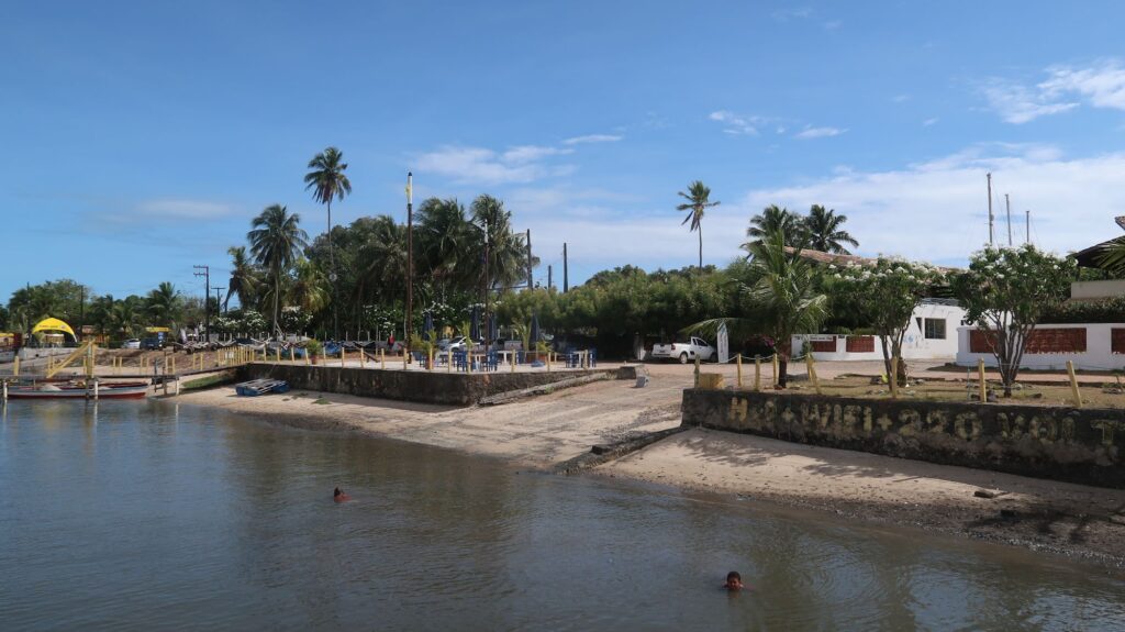
Jacare is a old, fairly undeveloped area situated on the river bank about 4 miles south of Cabedelo and 5 miles north of Joao Pessoa, a much larger and more stylish city with high-rise condos overlooking seemingly endless expanses of white sand beaches. With an international airport, it is an up and coming city in Brazil. Hiway BR320 runs north-south down the center of the pennisula from the industrial Port of Cabedelo through Jacare into Joao Pessoa and further south. The ocean (beach) side of the hiway is where the new developments are happening, with upscale shops and condos while the western side of the hiway facing the river is rundown and impoverished in many places, including the neighborhood immediately around the marina. Nonetheless, Jacare is where all the pleasure boats are, both locals and visitors like me. 

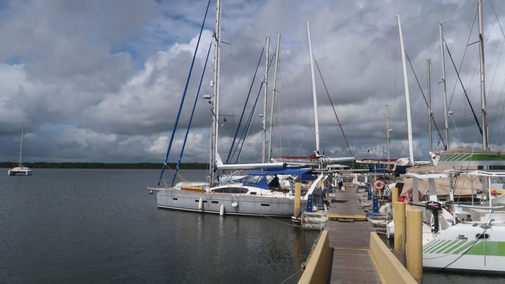
There is a restaurant/bar at the marina open for lunch and dinner.  It was the best place to eat within walking distance so I ate there often. Most of the patrons were people off the the boats in the marina. Of the 14-16 boats in the marina (which could hold maybe 30) only about 8 had people staying on board. Two left while I was there leaving a pretty small group that hung out in the restaurant/bar. There was a English father-son crew who arrived 2 days before me from Mindelo in the Cape Verde Islands. They had damaged sails and luckily found a competent sailmaker to get them fixed. There were headed for Cape Town. Interestingly, there was a parapeligic English guy, Tom, and his Canadian girlfriend Hannah who were sailing a large, custom-designed catamaran that accommodated Tom’s condition. In 2021, with other crew, he had sailed it across the Atlantic from Europe to the Caribbean. With Hannah,  and a few others at times, they had sailed from the Caribbean to Cabedelo. They plan to head south to the Beagle Channel so I may see them again at some point.

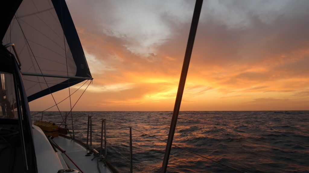
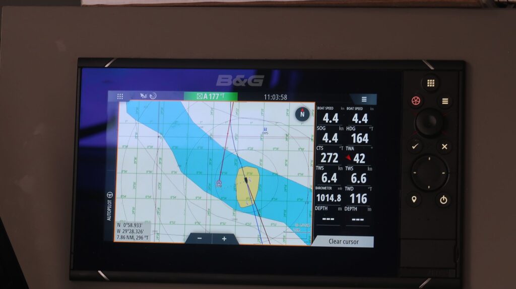
The first day and half out from Cabedelo the winds were light and variable, often headwinds, so I tacked several times trying to make useful progress. By Wednesday night the winds settle in from the northeast so I could set the boat up for a port side broad reach and make good progress. With winds in the 15-18 knot range I was getting boat speeds of 6-7 knots which is good for a boat like Phywave. Before today I had sunny conditions and was able to recharge my batteries from the solar panels, primarily, and the wind generator secondarily. In direct sun the solar panel with produce 25- 30 Amps. It takes 20 knots of relative wind for the wind generator to produce 8-10 Amps.

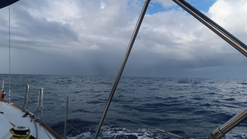
Today, Saturday, the sky is overcast with scattered cloud buildups and intermittent light rain showers.  A squall line is looming 6 miles to the east as I write this. I’m still making good progress south but I expect more cloudy, volatile weather over the next few days. I will definitely be using the generator tonight to recharge boat batteries.

Cabedelo, Brazil Arrival

I arrived in Cabedelo, Brazil, on the morning of November 14, 2022, completing my second Atlantic crossing. Since leaving Norfolk, VA, on August 2 I’ve crossed the Atlantic twice, landed on three continents, visited 5 ports, and put 6880 nm under the keel of my boat Phywave. I’m now stern-tied in Marina Jacare Village, a small, friendly marina on the east bank of the Paraiba River. The drawback is it’s pretty isolated. The immigration and customs I had to visit are miles away north at the Port of Cabedelo while the Port Authority (navy) is in Joao Pessoa several miles to the south.

Yacht crews usually take taxis to these locations which must be visited both on arrival and departure. I rented a car to make it all easier and gave a lift to these places to a British father-son crew who arrived a day before me and will leave for Cape Town next week. The nearest ATM is a 25 minute walk from the marina, the nearest supermarket even further. Getting clean diesel also requires a trip to a nearby gas station with jerry cans. I don’t know what the rental car place will say when I return the car with a faint odor of diesel inside. With all the running around prepping the boat for the next passage I really haven’t had much chance to enjoy the place, Many of the chores are now done so I’ll have a few days to relax.

My original route plan as posted on the website map showed me stopping in Uruguay, and I also thought of sailing directly from Cabedelo to Puerto Williams, a 3500 nm passage. I’ve now decided to sail from here to Mar del Plata, Argentina, about 2400 miles and good way to break up the passage to Puerto Williams. It will leave about 1100 nm to Puerto Williams but perhaps more importantly, will be good place to jump on a fair weather window for passage along the Argentina coast which is sometimes subject to challenging wind and sea conditions. I’ve already made contact with a marina at Mar del Plata who are happy to welcome me there, and happy to email me in English since my Spanish is pretty limited.

So, that’s the plan.

Sailing passed the Cape Verde Islands enroute to Brazil
Beautiful sunset
A rain squall about to clobber me
The e-charts around St. Peter and St. Paul Archipelago are wildly wrong. This shows my boat sailing across land that doesn’t exist.
St. Peter and St. Paul Archipelago
Marina Jacare Village
Phywave stern-tied in Marina Jacare Village

Crossing the Equator Southbound

At about 0623 Zulu on November 10, 2022, I crossed the equator southbound so I’m now officially in the Southern Hemisphere. It was an hour before dawn so I waited until the sun was up for a ceremony of giving a dram of whiskey to Neptune for continued safe passage as I had done at other significant milestones on this voyage. I made a short video of this one which I’ll post at some point.

Thursday also marked the day the sailing weather finally turned favorable. For the last several days I had 13-15 kt winds at 150-160 degrees True. With those winds I couldn’t really sail my desired course of 205-210 degrees, I had to sail off to the west which was problematic because I anticipated ocean currents that would also push me west, perhaps too far west to make the eastern bulge of the Brazilian coast. For that reason one guidebook said to cross the equator no further west than 28 degrees west longitude. I ended up crossing at about 29 degrees 50 minutes west. But that day the winds finally rotated to the east, to 100-120 degrees as expected with SE trade winds. I am now comfortably sailing a beam reach on the course I want making good speed so the current push west is no longer an issue. The weather forecast models I use were also wrong about when the winds would rotate east.

Just north of the equator is the Saô Pedro e Saô Paulo Archipelago, a small group of rocky outcroppings in the ocean far from anywhere. Even so, it is a occupied Brazilian outpost for maintaining the navigation light and I suppose other activites. Anyway, I made a diversion in my sailing route to pass very close by and get some great photos, especially of the waves crashing against the rocks erupting in geysers of water higher than the top of the lighthouse. There was a boat there, tied to  a mooring buoy. I’m not sure if it was supply boat or just a fishing boat. Before I could even see the place over the horizon I heard radio conversations on marine channel 16 in Portuguese, I assume between the boat and the shore facility. It’s a rare faraway place you can’t see via any tourist conveyance so that’s the main reason I made a point of sailing there.

Lanzarote to Brazil Days 5-14

November 4, 2022. From my last blog entry a while ago I decided to go west around the western shore of Santo Antao Island. It was a lucky move. Sailing maybe 10 miles offshore I was able to pick up a solid 3G data signal on my cellphone for a few hours. That let me catch up on email I don’t receive on the boat but also to download an important document that was too large to download on the low bandwidth Iridium satellite link on the boat. That document was the Waste Permit for my voyage to Antarctica issued by the US National Science Foundation (NSF). 

The day before leaving Lagos I received the other important document I need to sail to Antarctica –  a letter from the Environmental Protection Agency (EPA) approving my Initial Environmental Evaluation (IEE). The IEE is a detailed 25 page document that explains the purpose for the expedition, where I plan to go in Antarctica, what I plan to do at those locations, how I plan to protect the environment and wildlife, and how I am prepared to handle emergencies with the aim toward being completely self-sufficient. The Waste Permit application was similar except much shorter and focused on how I would handle waste produced by the expedition.

For both documents I had to explain in some detail my propsed use of a drone (UAV), both its operational use and how I would recover it, on both land and water, if something went wrong and it crashed.  Recreational drone use is not allowed on the tourist ships visiting Antarctica (under IAATO rules) for good reasons. Imagine putting 100 tourists ashore on some penguin colony island and 20 of them want to launch drones – it would be total chaos! Especially when you consider that most would not be skilled drone pilots.  So getting permission to use my drone in Antarctica for recreational is a rare thing that could only haporn with a private expedition, not an IAATO-sanctioned tour.

So I have all the approvals I need to take my boat to Antarctica as an expedition of one.   Now it’s just a matter of sailing there – not so simple, but I’m finally sailing west and south – in the right direction.

Note that I had to submit the same documents and get the same approvals when I flew my plane to Antarctica in 2014. The EPA and NSF were accustomed to dealing with yachts visiting Antarctica so my flight was a first for them. Ultimately those documents were much simpler than for a yacht, but the experience on creating them, and getting them approved,  gave me a format for what I needed to submit to sail there. 

Turning south after passing Santo Antao I had some good downwind sailing for a few days. But as I crossed 10 degrees north latitude sailing south things changed dramatically. The Inter-Tropical Convergence Zone lies at these latitudes. The sky got gloomier, the wind shifted to the east, and in the middle of the night I was surrounded by thunderstorms. One storm eventually hit me, the wind speed rapidly rising above 30 kts with torrential rain and heavy waves. I scrambled to reduce sail, getting soaked in the process, then just hung on as the storm moved over and passed me. It came in so fast I was really not ready. I set my high wind alarm at 35 kts (gale force winds) – it was going off almost continously.  Of course everything is more difficult and un-nerving when it’s a pitch black night.

Thst was the first of three other such episodes, though two occurred during daylight. I’ve also had heavy rain with little increase in wind. Curiously, my radar does not show much for thunderstorms, unlike the rain squalls, which it showed in detail, when I was crossing the Atlantic eastbound. The boat’s radar is designed to show things on, and just above, the water; i.e., at low elevation angles. Thunderstorms, being much higher, don’t register except when their rain is falling intensely.

I’m happy to say that as I sail farther south I believe I’m getting clear of these storm patterns. The southern sky this morining, November 4, is looking more promising and hopefully I’ll soon have some sunshine and steadier winds.