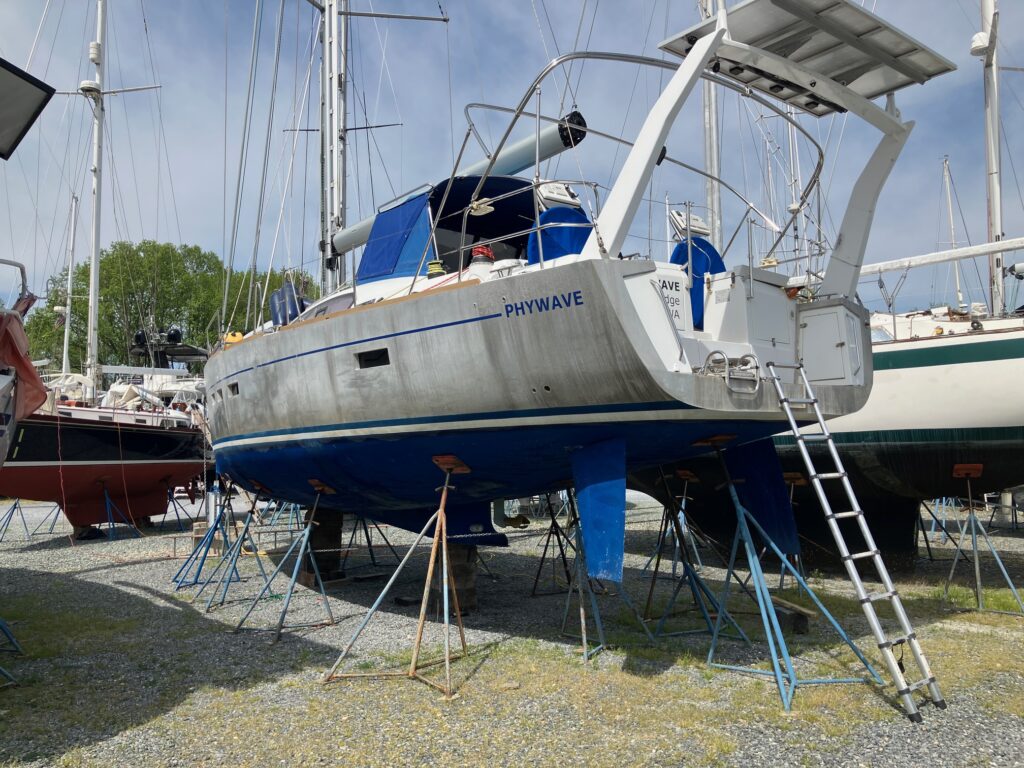
I’ve completed the commissioning of Phywave – the engine, generator, watermaker, freshwater and other water systems flushed out and running, replacing the non-toxic antifreeze that was in there to keep them from freezing. They had some exceptionally cold weather here this past winter.
I bought a new 100 meter 10 mm G4 chain and 25 kg Rocna vulcan anchor.
I’ll be replacing the Webasto heater this week because I still can’t get it to run even after completely redoing the fuel system. The fuel system is now delivering clean, metered fuel to the heater but it still won’t start. It’s likely a problem with the glow plug or combustion chamber. I watched a YouTube video of how to replace these components. Pretty complicated and time consuming – you have remove the heater and basically disassemble the whole unit to replace these parts. And the service kit with the required parts is almost $500. For about 3 times as much I can a new heater and just drop it in. Hopefully that will get it going again. I really want to have the heater working fo my voyage into the Arctic.
I’ll also replace the exhaust elbow on the Volvo Penta D2-50F engine with a stainless steel version. This elbow rusted through in Indonesia causing a lot of problems. I had no choice there but to replace it with another cast iron version but I don’t trust it not to rust out again so I’m replacing it with a stainless steel elbow as many others have.
I’ve installed a new Vitrifrigo 2 drawer refrigerator/freezer combination to replace the 2 drawer refrigerator-only I had before.
I replaced all the plastic diesel jerry cans I bought in Puerto Montt, Chile, with new ones, and added 8 more. That gives me a total diesel capacity of 860 liters. That may seem excessive for a sailboat but for where I may be going, it may be necessary.
I have many other small projects to complete. I’m also reorganizing the boat and jettisoning stuff I never used and now realize I never would use. I learned things on my 7 continents voyage about organizing and running a boat.
I decided to install lithium house batteries but I’m hedging my bet by installing an additional AGM start battery in parallel with the first and a crossover switch so I can run the house off the start batteries if necessary. The lithium’s have internal battery managment systems (BMS) that with shut the batteries off if it detects an unsafe condition like a too-high charging voltage. That would leave the boat totally dark – no nav, no AIS, no AP, no lights, nothing. So I want to be able to quickly switch to an alternate power source while I address the problem. The battery project also includes some upgrades like replacing the Victron inverter with a Victron Multiplus that will serve as both charger and inverter.
Right now I’m more concerned about scheduling. To meet my sailing schedule for this summer, I really want the boat back in the water the first week of June when I’ll be heading north for Newfoundland. The major remaining projects are:
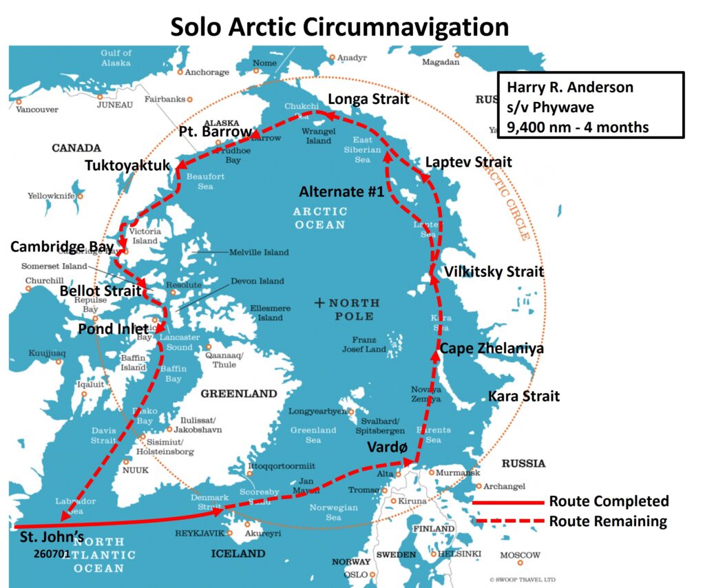
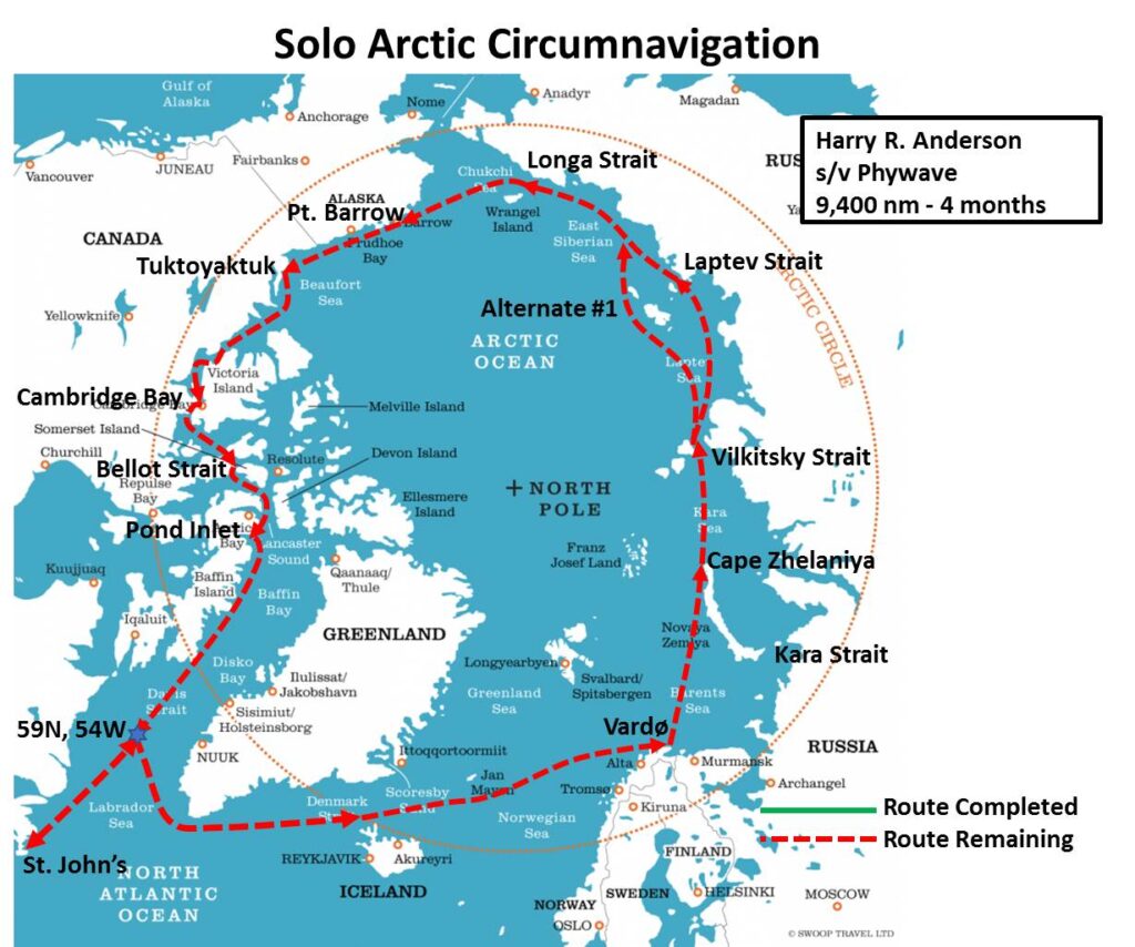
1. Anti-fouling paint. I’m trying to get the hull blasted and all new barrier coats and anti-fouling applied but the well-regarded contractor here is dragging their feet a bit. UPDATE 260512: I met with them and they are definitely committed to having the boat ready for the water by June 1. I explained my ambitious Arctic circumnavigation plans and emphasized the importance of leaving here on time so I can position Phywave to take advantage of the narrow time window when the Arctic passages will be open.
2. Battery project. The gear is here but getting the techs scheduled to do the installation will require some push. I also had them commit to finishing by June 1 before I paid the deposit. UPDATE 260511: I got a call first thing this morning that they will start work today. An ABYC technical is already at Phywave so I gave him the combination to the lockbox so he could get inside and start work before I get down there.
3. Rigging inspection, headsails back on, lubricate everything, etc. I have the riggers lined up for this as soon as Phywave is back in the water. Riggers will only climb a mast with the boat in the water. On land the extra tipping moment of having someone at the top of the mast could cause the boat to tip out of its blocks. Once in the water, the boat can tip and right itself as it normally does when sailing. I don’t expect any problems here. I’ve already replaced some lines that were chafed and so infused with salt they squeaked going through the winches.