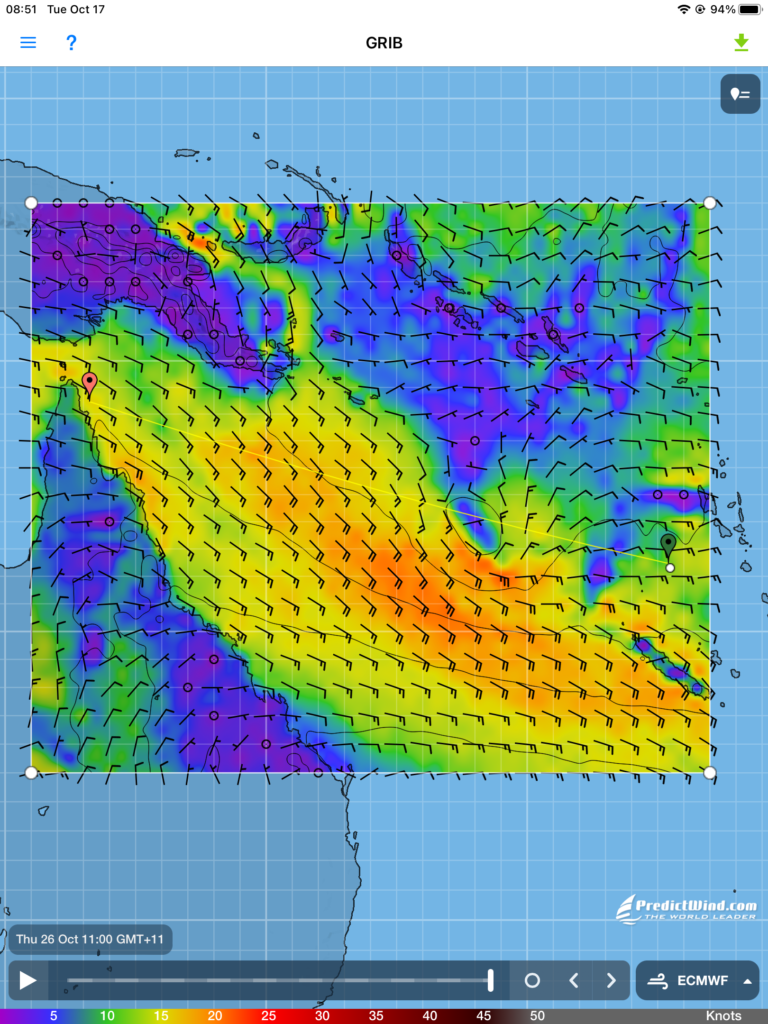
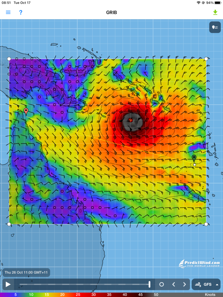
I can download a number of weather forecast maps based on different forecast models but the two I mainly use are the ECMWF model (known as the European model) and the GFS model (known as the American model). I’ve tended to rely on the European model because it can offer somewhat higher resolution and seems to have been a little more accurate when comparing the forecast conditions to the conditions I’m actually experiencing. All the model forecasts tend to converge as you get closer to a forecast day and time, as you might expect.
The ECMWF and GFS models provide forecast out to 10 days. I usually want to see that so I have as much notice as possible on what to expect and can make adjustments to my sailing plan as early as possible. When I was flying my plane around the world I didn’t need such long term warnings. My flight legs were typically only 5-6 hours long so I was just looking for suitable weather windows to keep moving forward. Otherwise, the plane is safe on the ground if bad weather arrives.
As I start out westward across the Coral Sea I’ve looked at the forecasts from the ECMWF and GFS models 10 days out , as shown in these screen captures. The GFS model shows a typhoon moving south westward over the Solomon Islands while the ECMWF model shows a benign low pressure system in the same place. The websites that specifically track South Pacific tropical cyclones (typhoons) have no alerts about tropical depressions or waves that could develop into cyclones.
What to believe? If the typhoon is real, it is moving westward toward the Torres Strait where I plan to be about the same time. That’s an untenable situation. So in case it’s real I need an alternate plan. That alternate plan is to now steer for a point just north of a tiny island/reef called Sand Cay, a course slightly south of the course directly to Torres Strait. From the Sand Cay waypoint I would be only about 200 nm from Cairns, Australia. That’s about 1.5 days in the boat so if I need to run for shelter that will be my plan. If no storm develops I can just turn north and head for Torres Strait, and of course alter my course at any time if it becomes clear no storm will develop.
There is also the option to heave-to and just drift around south of the storm track, then resume my course to Torres Strait once it has passed.
I will eagerly download each new set of forecasts as they’re produced every 12 hours to see what’s happening. A typhoon this early (October) would be very rare. The tropical storm season here officially runs from November to April with most cyclones occuring from December to March.
Planning for contigencies like this days in advance is an element of sailing the oceans that I didn’t experience when flying across the oceans. Let’s hope the GFS-forecast typhoon never materializes.