Mar del Plata

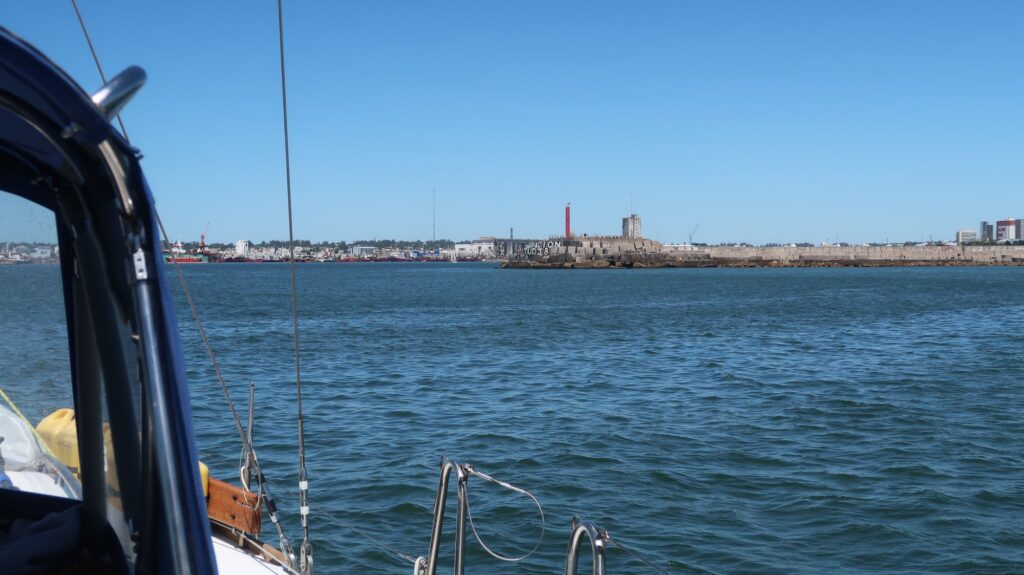
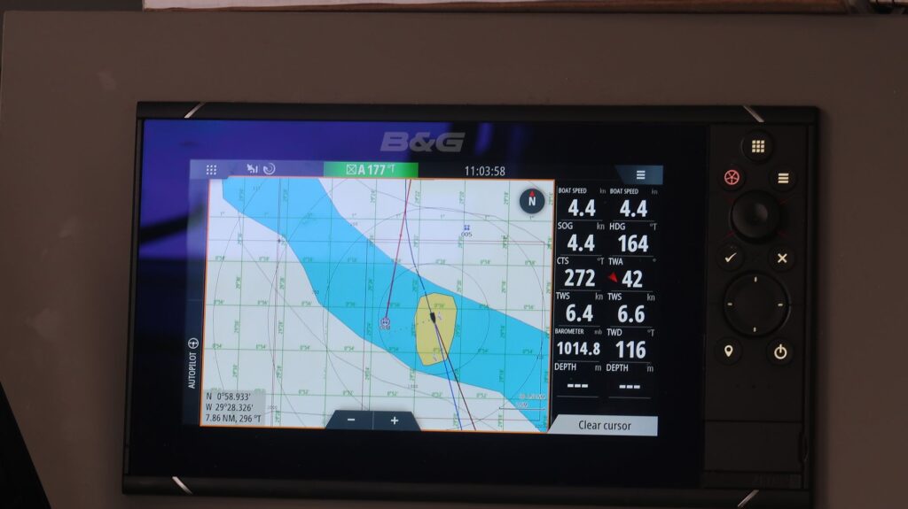
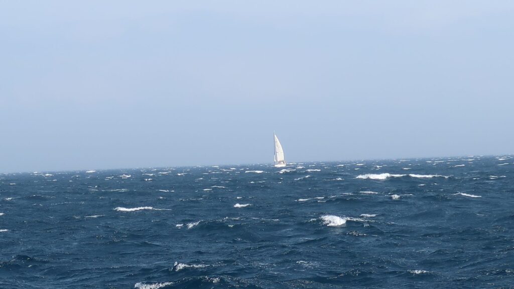
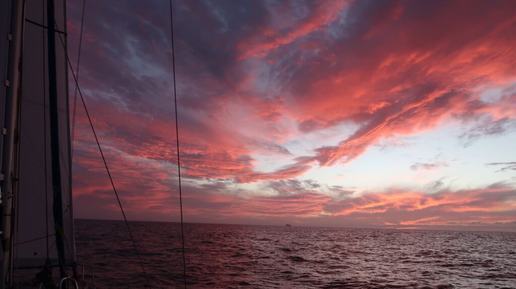
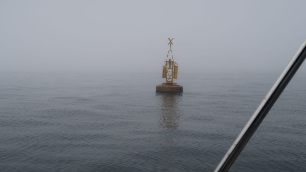
I arrived in Mar del Plata on Tuesday morning, December 13, after several days of variable winds. For the final 12 hours I had wind right on the bow so I had no choice but to use the engine to make tangible progress and arrive at the marina during daylight hours.

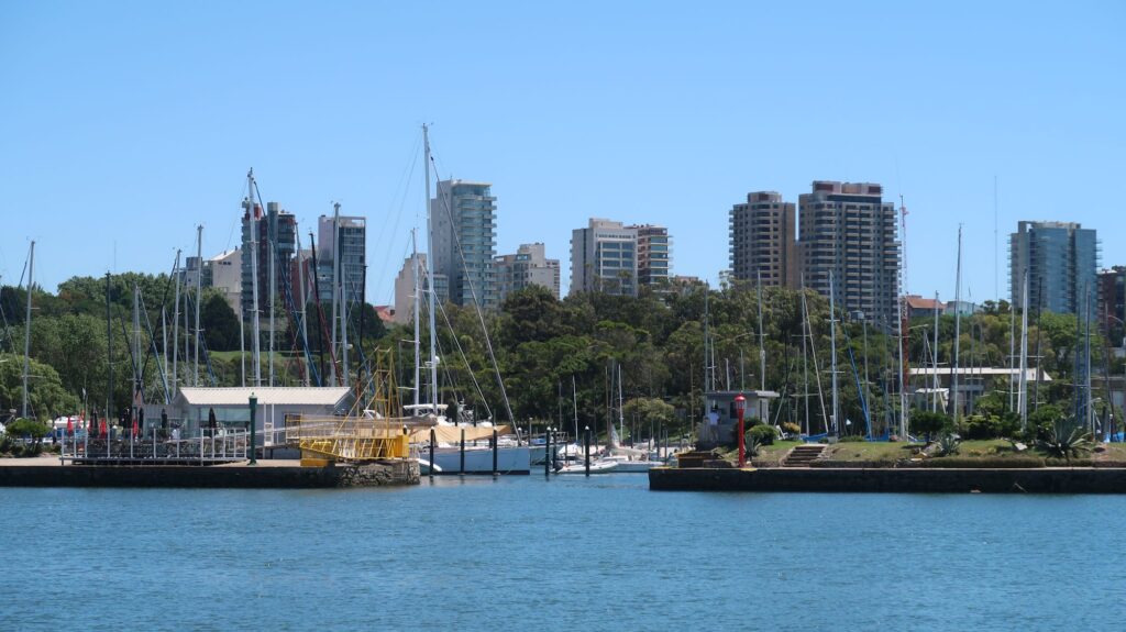
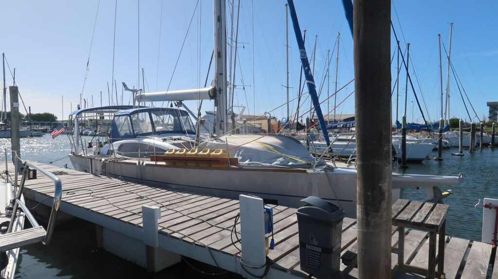
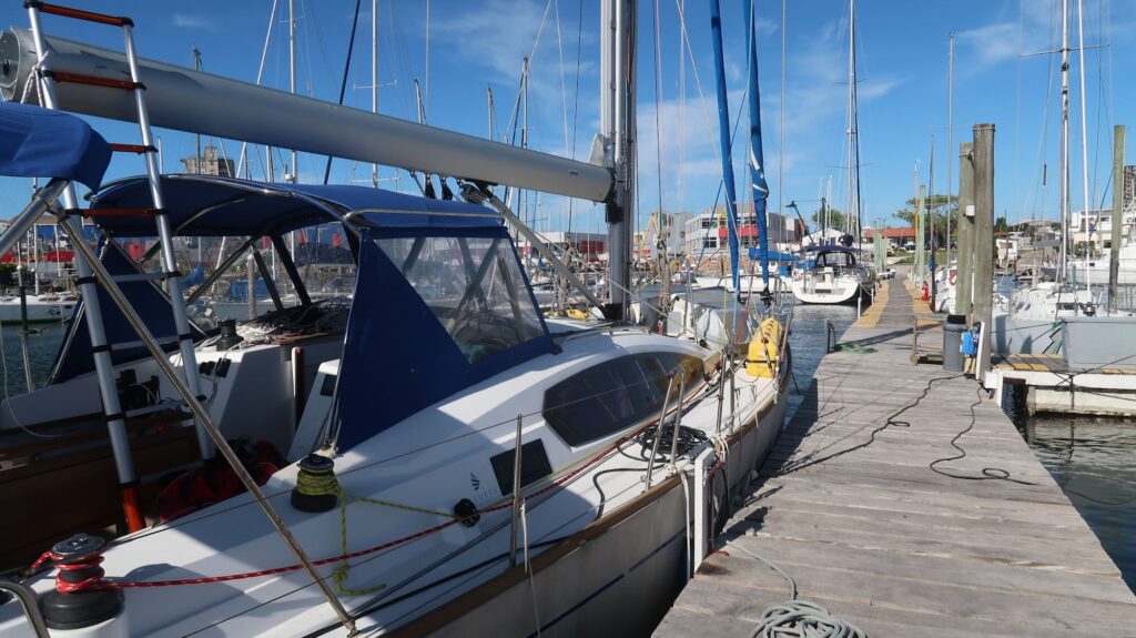
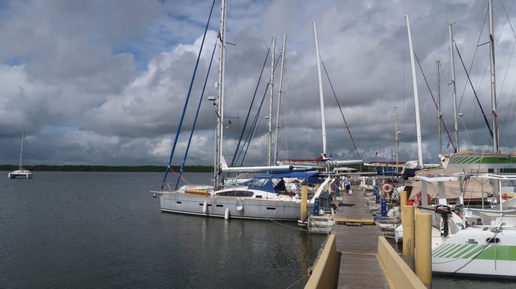
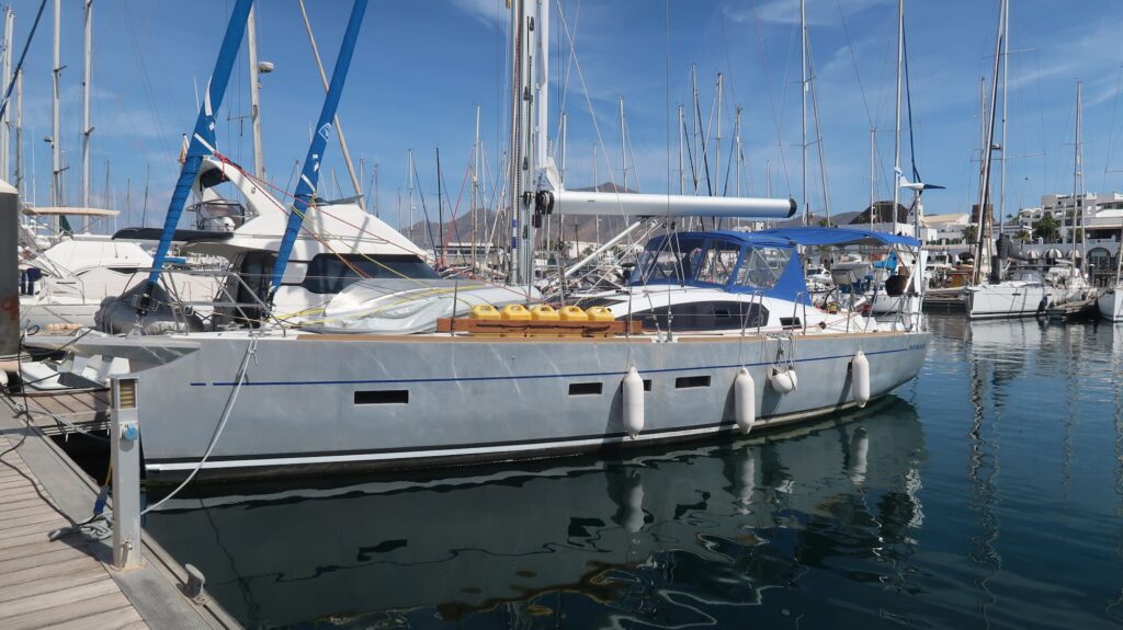
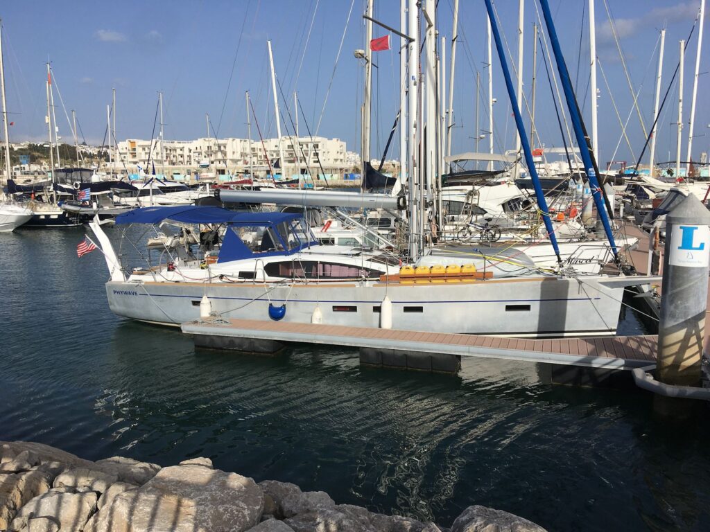
Yacht Club Argentino (YCA) has a marina which can accommodate boats the size of Phywave so that’s where I was headed having contacted them a few weeks before to set it up. There is a yellow pedestrian swing bridge that must open for access to the mooring berths.  Outside the swinging bridge I was surprised to be met by two dinghies from YCA that tied Phywave  to a mooring buoy for about 30 minutes until the dockmaster could come out and lead me to my berth.  While the marina generally had European-style stern tie berths with pilings, the place they had for me was a side-tie to a long pontoon. It was easy to dock with them handling lines and will be easy to back out when I leave.

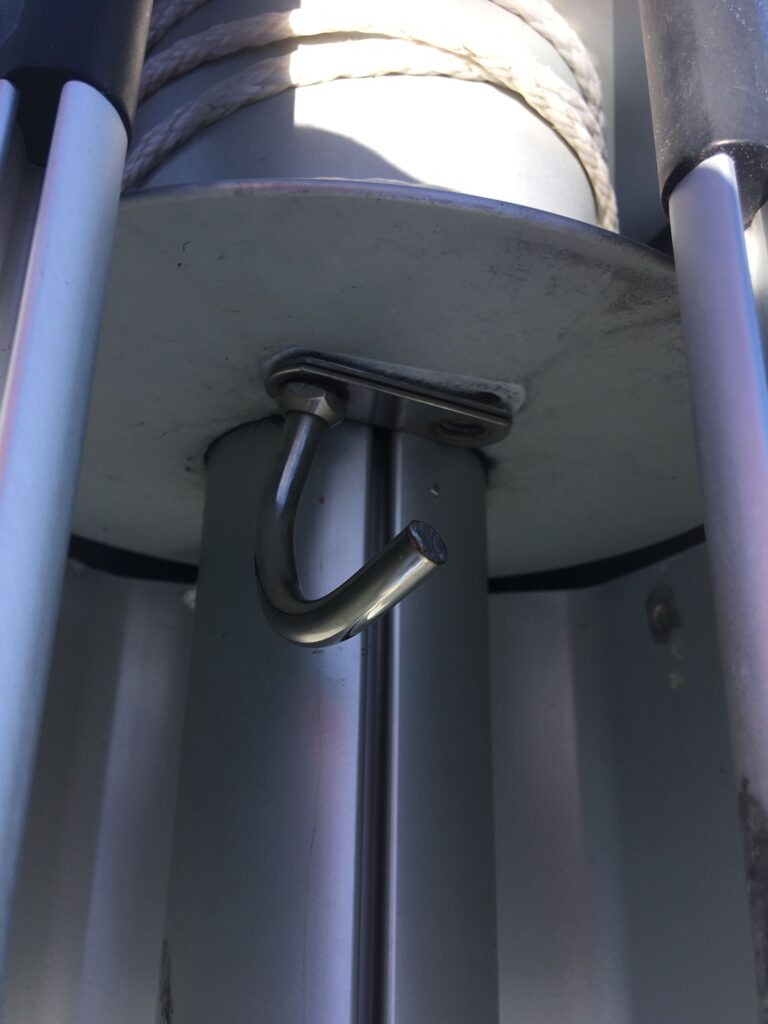
I originally planned Mar del Plata to be a short stop of a few days to re-provision the boat.  However, late in the passage from Cabedelo I had a serious failure – the u-bolt that attaches to the clew of the mainsail broke so when the sail was fully deployed the clew was flying free – not good.   I had to roll in the sail to the first reef to keep it under control. Even so, the tension on the clew along the foot and leach of the sail was lost. It wasn’t possible to attempt a repair or even investigate what had happened since the boom is high above the cockpit and I have to use an extension ladder I have on board to climb up there to look at the clew attachment u-bolt. I wasn’t going to try to set up the ladder while rolling around at sea.  When I finally was tied to the dock at YCA I climbed up there and found that one side of the stainless steel u-bolt that’s tied to the clew had sheared off so the clew slipped off the bolt. It’s a substantial u-bolt so I was really surprised if sheared off the way it did.  Anyway, one at the dock I was immediately engaged to trying to find a fix.  Just getting the boom furling drum apart to remove the broken u-bolt took a video sent to me by Schaefer, the boom manufacturer. Since a replacement u-bolt is not available locally, we will use a temporary fix with a soft shackle made from spectra line, strong stuff and ought to suffice until I can get the replacement u-bolt from Schaefer and install it.  The upside, I suppose, if there is one, is that I now know the Schaefer furling boom construction much better than before.  I hope to get the bush fix in and be on my way next Tuesday or Wednesday. From the blogs I’ve read by other cruising boats, it’s pretty routine to periodically have to fix broken things. Maybe I’ve been lucky before this point in having no major problems.

The marina at Mar del Plata is not in the greatest part of town.   And for some reason none of the ATM’s will accept my card so I’ve been here several days with no Argentine pesos in my pocket.  My card has worked in restaurants and shops  but I’m pretty sure I will need pesos to pay for the boom repairs.  I’ll have to track down to a money changer somewhere in this town.

I decided to take a break from living on the boat and booked a couple of nights in an ocean view room at a hotel that’s walking distance from the marina, where I am this morning.  The hotel also has fast wifi, unlike the marina, so I can update all the apps and charts on my iPads and iPhone and download a bunch more books. 

I’ve found a fairly large supermercado for provisions but I’ll have to use an Uber to transport the pile of supplies back to the marina.  I have a long list since will, in part, be shopping for the passage to Antarctica as well. The shops in Puerto Williams, the jumping off point for sailing to Antarctica, apparently have just basic things.  Puerto Williams is a small town, population about 2200, so no supermercados.

Houses along Paraiba river leaving Cabedelo
Nice day at sea
Shortly after sunrise
Sunset
When True Wind Direction (TWD) and True Wind Speed (TWS) vary this much over 60 minutes it’s really hard to set sails to make any reasonable progress. It shows how radically things can change in just a few minutes
The entrance to the port at Mar del Plata
The pedestrian swing bridge (open) at the entrance to the marinas at Mar del Plata

Phywave on the pontoon at YCA
Sheared off u-bolt on furling drum in Schaefer boom

Cabedelo to Mar del Plata Passage, Days 5-12

This past week of sailing has been challenging, with the strongest winds and roughest seas I have encountered since beginning this voyage.  There was a strong high pressure system sitting off the coast of Brazil creating gale force winds and 3-4 meter seas. There were continuing warning messages about it day after day in the weather forecast. Rather than go close along coast where the winds might be weaker, as some of the routing algorithms suggested, I opted to stay far offshore and skirt the gale area sailing due south rather than following the coastline westward.  The wind forecast files showed somewhat weaker winds farther east. Though this would lengthen my passage to Mar del Plata, dealing with less wind and no nearby shoreline with possible hazards made it worth it.

For 5 days I had 25-30 knot winds on the port beam or slightly aft, gusting to over 35 knots during frequent rain squalls. The seas were running at 3 meters making for a very rolly ride.  It was an effort to move around the boat and prepare meals.  I had 3 reefs in the mainsail and just a small triangle for a headsail (more than 3 reefs) to try to balance the helm. I was making good speed but not exactly in the direction I wanted to go. I tried to take this in stride as a preview of rough conditions I’m sure to encountered farther south.

On Friday afternoon these conditions finally moderated, pretty much as the forecast predicted, and the wind backed toward the north. The high wind-high seas warning messages in the forecast are now gone.  I gradually turned off my southernly heading toward the southwest. Last night the sky was clear enough that I saw the sunset for the first time in nearly a week.

This morning, Sunday, I jibed over to a starboard tack and set a course over ground (COG) of 235 degrees that takes me straight to Mar del Plata. There are just under 900 nm to go. The forecast calls for a stretch of dead air (no wind) I’ll have to motor across. Hopefully no difficult weather systems pop up on my route during the next 8 days it will take to get to MDP.

I’ve occupied myself by reading, actually re-reading novels stored on my iphone that I read years ago. They seem like new books, the stories only vaguely familiar, but none of the details. I’ve also been reading the cruising guidebooks I have for going southbound along the Argentine coast, through the Le Maire Strait and into the Beagle Channel westbound, about 1200 nm sailing distance from MDP.

Besides reprovisioning and resting, one of the main reasons for the stop in MDP is to assess the weather forecasts for this 1200 nm passage. The Argentine coast is subject to fast moving cold fronts with very strong winds (pamperos) that roar unabated across the flat plains (pampas) of Patagonia from the Andes. I certainly had my experiences with these winds when I flew my plane through Patagonia in 2013 and 2014.

I would like to avoid these  cold fronts/squall lines if possible but if not I’ll have to heave-to (stop sailing and point the boat 45-50 degrees off the wind). The boat will drift more or less downwind at 1 to 2 knots. Every boat heaves-to differently.  I experimented with Phywave a week ago but with only 15 knots of wind. Two reefs in the mainsail, no headsail, and rudder tied down hard to lee seemed to balance the boat with a drift of about 120- 135 degrees off the wind direction.  I don’t know how well this setup will work in 40-50 knots of wind I might expect from a pampero.  Typically the front passes in 12 hours, though sometimes it may be longer. At least the winds will generally will be out of the west so the drift direction will be out to sea and open water rather than toward the shore which would be a definite hazard. There are also a few anchorages where I might be able to take shelter with enough warning.  Generally, though, it’s better to take my chances in open water rather than attempt a uncertain run to an anchorage. Closed up tight, the boat’s not going to take on water so it’s a matter of finding a configuration where it rides reasonably stable until the front passes.

Passing through the Le Maire Strait is a completely separate challenge of finding the right wind-tidal current combination. I’ll discuss that in some later post.

Cabedelo to Mar del Plata, Days 1-4

I left Marina Jacare Village on Tuesday morning, November 22, and made my way north along the Paraiba River for a few miles before turning seaward in the narrow, marked channel passing the north end of the pennisula where the town of Cabedelo is actually located. Slack tide had just passed so I was slowed by a building flood current.

Jacare is a old, fairly undeveloped area situated on the river bank about 4 miles south of Cabedelo and 5 miles north of Joao Pessoa, a much larger and more stylish city with high-rise condos overlooking seemingly endless expanses of white sand beaches. With an international airport, it is an up and coming city in Brazil. Hiway BR320 runs north-south down the center of the pennisula from the industrial Port of Cabedelo through Jacare into Joao Pessoa and further south. The ocean (beach) side of the hiway is where the new developments are happening, with upscale shops and condos while the western side of the hiway facing the river is rundown and impoverished in many places, including the neighborhood immediately around the marina. Nonetheless, Jacare is where all the pleasure boats are, both locals and visitors like me.

There is a restaurant/bar at the marina open for lunch and dinner.  It was the best place to eat within walking distance so I ate there often. Most of the patrons were people off the the boats in the marina. Of the 14-16 boats in the marina (which could hold maybe 30) only about 8 had people staying on board. Two left while I was there leaving a pretty small group that hung out in the restaurant/bar. There was a English father-son crew who arrived 2 days before me from Mindelo in the Cape Verde Islands. They had damaged sails and luckily found a competent sailmaker to get them fixed. There were headed for Cape Town. Interestingly, there was a parapeligic English guy, Tom, and his Canadian girlfriend Hannah who were sailing a large, custom-designed catamaran that accommodated Tom’s condition. In 2021, with other crew, he had sailed it across the Atlantic from Europe to the Caribbean. With Hannah,  and a few others at times, they had sailed from the Caribbean to Cabedelo. They plan to head south to the Beagle Channel so I may see them again at some point.

The first day and half out from Cabedelo the winds were light and variable, often headwinds, so I tacked several times trying to make useful progress. By Wednesday night the winds settle in from the northeast so I could set the boat up for a port side broad reach and make good progress. With winds in the 15-18 knot range I was getting boat speeds of 6-7 knots which is good for a boat like Phywave. Before today I had sunny conditions and was able to recharge my batteries from the solar panels, primarily, and the wind generator secondarily. In direct sun the solar panel with produce 25- 30 Amps. It takes 20 knots of relative wind for the wind generator to produce 8-10 Amps.

Today, Saturday, the sky is overcast with scattered cloud buildups and intermittent light rain showers.  A squall line is looming 6 miles to the east as I write this. I’m still making good progress south but I expect more cloudy, volatile weather over the next few days. I will definitely be using the generator tonight to recharge boat batteries.

Cabedelo, Brazil Arrival

I arrived in Cabedelo, Brazil, on the morning of November 14, 2022, completing my second Atlantic crossing. Since leaving Norfolk, VA, on August 2 I’ve crossed the Atlantic twice, landed on three continents, visited 5 ports, and put 6880 nm under the keel of my boat Phywave. I’m now stern-tied in Marina Jacare Village, a small, friendly marina on the east bank of the Paraiba River. The drawback is it’s pretty isolated. The immigration and customs I had to visit are miles away north at the Port of Cabedelo while the Port Authority (navy) is in Joao Pessoa several miles to the south.

Yacht crews usually take taxis to these locations which must be visited both on arrival and departure. I rented a car to make it all easier and gave a lift to these places to a British father-son crew who arrived a day before me and will leave for Cape Town next week. The nearest ATM is a 25 minute walk from the marina, the nearest supermarket even further. Getting clean diesel also requires a trip to a nearby gas station with jerry cans. I don’t know what the rental car place will say when I return the car with a faint odor of diesel inside. With all the running around prepping the boat for the next passage I really haven’t had much chance to enjoy the place, Many of the chores are now done so I’ll have a few days to relax.

My original route plan as posted on the website map showed me stopping in Uruguay, and I also thought of sailing directly from Cabedelo to Puerto Williams, a 3500 nm passage. I’ve now decided to sail from here to Mar del Plata, Argentina, about 2400 miles and good way to break up the passage to Puerto Williams. It will leave about 1100 nm to Puerto Williams but perhaps more importantly, will be good place to jump on a fair weather window for passage along the Argentina coast which is sometimes subject to challenging wind and sea conditions. I’ve already made contact with a marina at Mar del Plata who are happy to welcome me there, and happy to email me in English since my Spanish is pretty limited.

So, that’s the plan.

Sailing passed the Cape Verde Islands enroute to Brazil
Beautiful sunset
A rain squall about to clobber me
The e-charts around St. Peter and St. Paul Archipelago are wildly wrong. This shows my boat sailing across land that doesn’t exist.
St. Peter and St. Paul Archipelago
Marina Jacare Village
Phywave stern-tied in Marina Jacare Village

Crossing the Equator Southbound

At about 0623 Zulu on November 10, 2022, I crossed the equator southbound so I’m now officially in the Southern Hemisphere. It was an hour before dawn so I waited until the sun was up for a ceremony of giving a dram of whiskey to Neptune for continued safe passage as I had done at other significant milestones on this voyage. I made a short video of this one which I’ll post at some point.

Thursday also marked the day the sailing weather finally turned favorable. For the last several days I had 13-15 kt winds at 150-160 degrees True. With those winds I couldn’t really sail my desired course of 205-210 degrees, I had to sail off to the west which was problematic because I anticipated ocean currents that would also push me west, perhaps too far west to make the eastern bulge of the Brazilian coast. For that reason one guidebook said to cross the equator no further west than 28 degrees west longitude. I ended up crossing at about 29 degrees 50 minutes west. But that day the winds finally rotated to the east, to 100-120 degrees as expected with SE trade winds. I am now comfortably sailing a beam reach on the course I want making good speed so the current push west is no longer an issue. The weather forecast models I use were also wrong about when the winds would rotate east.

Just north of the equator is the Saô Pedro e Saô Paulo Archipelago, a small group of rocky outcroppings in the ocean far from anywhere. Even so, it is a occupied Brazilian outpost for maintaining the navigation light and I suppose other activites. Anyway, I made a diversion in my sailing route to pass very close by and get some great photos, especially of the waves crashing against the rocks erupting in geysers of water higher than the top of the lighthouse. There was a boat there, tied to  a mooring buoy. I’m not sure if it was supply boat or just a fishing boat. Before I could even see the place over the horizon I heard radio conversations on marine channel 16 in Portuguese, I assume between the boat and the shore facility. It’s a rare faraway place you can’t see via any tourist conveyance so that’s the main reason I made a point of sailing there.

Lanzarote to Brazil Days 5-14

November 4, 2022. From my last blog entry a while ago I decided to go west around the western shore of Santo Antao Island. It was a lucky move. Sailing maybe 10 miles offshore I was able to pick up a solid 3G data signal on my cellphone for a few hours. That let me catch up on email I don’t receive on the boat but also to download an important document that was too large to download on the low bandwidth Iridium satellite link on the boat. That document was the Waste Permit for my voyage to Antarctica issued by the US National Science Foundation (NSF).

The day before leaving Lagos I received the other important document I need to sail to Antarctica –  a letter from the Environmental Protection Agency (EPA) approving my Initial Environmental Evaluation (IEE). The IEE is a detailed 25 page document that explains the purpose for the expedition, where I plan to go in Antarctica, what I plan to do at those locations, how I plan to protect the environment and wildlife, and how I am prepared to handle emergencies with the aim toward being completely self-sufficient. The Waste Permit application was similar except much shorter and focused on how I would handle waste produced by the expedition.

For both documents I had to explain in some detail my propsed use of a drone (UAV), both its operational use and how I would recover it, on both land and water, if something went wrong and it crashed.  Recreational drone use is not allowed on the tourist ships visiting Antarctica (under IAATO rules) for good reasons. Imagine putting 100 tourists ashore on some penguin colony island and 20 of them want to launch drones – it would be total chaos! Especially when you consider that most would not be skilled drone pilots.  So getting permission to use my drone in Antarctica for recreational is a rare thing that could only haporn with a private expedition, not an IAATO-sanctioned tour.

So I have all the approvals I need to take my boat to Antarctica as an expedition of one.   Now it’s just a matter of sailing there – not so simple, but I’m finally sailing west and south – in the right direction.

Note that I had to submit the same documents and get the same approvals when I flew my plane to Antarctica in 2014. The EPA and NSF were accustomed to dealing with yachts visiting Antarctica so my flight was a first for them. Ultimately those documents were much simpler than for a yacht, but the experience on creating them, and getting them approved,  gave me a format for what I needed to submit to sail there.

Turning south after passing Santo Antao I had some good downwind sailing for a few days. But as I crossed 10 degrees north latitude sailing south things changed dramatically. The Inter-Tropical Convergence Zone lies at these latitudes. The sky got gloomier, the wind shifted to the east, and in the middle of the night I was surrounded by thunderstorms. One storm eventually hit me, the wind speed rapidly rising above 30 kts with torrential rain and heavy waves. I scrambled to reduce sail, getting soaked in the process, then just hung on as the storm moved over and passed me. It came in so fast I was really not ready. I set my high wind alarm at 35 kts (gale force winds) – it was going off almost continously.  Of course everything is more difficult and un-nerving when it’s a pitch black night.

Thst was the first of three other such episodes, though two occurred during daylight. I’ve also had heavy rain with little increase in wind. Curiously, my radar does not show much for thunderstorms, unlike the rain squalls, which it showed in detail, when I was crossing the Atlantic eastbound. The boat’s radar is designed to show things on, and just above, the water; i.e., at low elevation angles. Thunderstorms, being much higher, don’t register except when their rain is falling intensely.

I’m happy to say that as I sail farther south I believe I’m getting clear of these storm patterns. The southern sky this morining, November 4, is looking more promising and hopefully I’ll soon have some sunshine and steadier winds.

Lanzarote to Cabedelo Days 1-5

I left Rubicon marina at the south end of Lanzarote Island at about 0840z on October 21, motoring SE into the channel where the winds were forecast to be stronger than on west side of Fuerteventura Island. After 5 hours of motoring the winds built sufficiently to start sailing. I’ve been sailing ever since, the engine off, generally downwind with occassional shifts that put the wind on the starboard quarter or beam. The boat actually sails better with the wind from those directions so I take advantage of it when I can.

With all the downwind sailing I decided to get more adept at setting the whiskerpole that wings out the genoa headsail to catch the most wind. As I may have mentioned in the past, it’s awkward to set mainly because I have the dinghy strapped down to the foredeck. It’s in the way when handling the whiskerpole. The whiskerpole itself is mounted on a track on the front on the mast. To set it, I have to unclip the end fitting attached to a bale at the foot of the mast, then use a line to lower the end of the pole riding on the mast track while I walk the end I just unclipped out to the bow where it can be clipped in to one of the genoa sheets at the genoa clew. With the boat rolling around this procedure can slow and unstable (the pole is free to swing around).

Outside the cockpit I’m always wearing my inflatable life vest which has a tether that can be clipped into various points on the boat to keep me from falling overboard and becoming detached from the boat. The grab bars, granny bars (around the mast) and pulpit are the best places to clip in but going forward to the bow my only options are the jacklines running the length of the boat. These lines are strong but are not very taut so a fall overboard clipped into a jackline would likely leave me dragging in the water along side the boat.

When you’re sailing single-handed there is no man overboard drill. Even though I have a waterproof PLB in a pocket on the life vest, falling overboard and becoming detached from the boat while far from land or other boats would pretty much be the end. So, to invoke a famous line from the movie “Apocalyse Now” – “Don’t get out of the boat”.

Once the pole is clipped into the genoa sheet it’s then a simple matter to return to the cockpit, release the genoa furling line, and then pull out the sheet and trim it to position the poled-out sail the way you want. The pole is great at keeping wind in the sail as the boat roles with passing seas.

Jibing (or gybing) the boat means turning the boat so the wind is coming from the other side of the stern, but still sailing downwind. Moving the mainsail boom to the

other side is one task I’ve mentioned before. It must be done in stages to keep the boom from slamming across the boat. I’ve got a boom brake which prevents that.

Moving the whiskerpole over to the other side is a challenge because I have a staysail, a second forestay aft of the main forestay where the genoa is furled. When initially setting the whiskerpole I have to choose which side of the staysail I will set it on. When jibing I have to furl the genoa, go back to the bow, unclip the pole from the sheet, then go back to the mast and hoist the track end of the pole far enough up the mast so the free end will swing around behind the staysail so it’s on the other side. With the boat rolling from side-to-side, this becomes a bit of a timing game. I have to lower the track end of the pole when the boat rolls and swings the pole so it’s on the other side of the staysail. If the dinghy weren’t there I could more easily walk the free end to the other side. Anyway, once the pole is on the correct side of the staysail the procedure involved is the same as described above.

Given the steps and work involved in jibing, I try to keep sailing with the wind on the starboard or port side of the stern as long as possible. With wind direction constantly shifting it could get a little crazy trying to follow all the shifts. I’m glad I’m not racing where that certainly would be an objective. Even so, over the first days I’ve averaged a boat speed of 5.2 knots. If I get a 5 kt average I’m happy; that’s 120 nm in a 24 hour day. With the genoa poled out I can get 6-7 kt boat speed with a 15-20 kt wind sailing downwind.

One reason I explained these pole-setting details is because the ocean is empty and there isn’t much else to talk about. I’ve had one group of dolphins swim by the boat a few days ago. This morning a school of flying fish came across the bow. They’ll fly for several meters just above the water before dipping back in.  Of course, there have bern the usual cargo and tanker ships passing by, and commercial fishing vessels of 30 meter in length. No small fishing skiffs. I usually leave the companionway open at night. A seabird (don’t know what kind) flew into the cabin, looking for a free ride I guess. They’ll make a mess on a boat so I had to trap it under a bucket, slip the bucket lid under the bucket, then release it off the stern. Not fun in the middle of the night. I now keep the companionway closed.

My next routing decision is whether to go west of the Cape Verde Islands or through them, trying to minimize the miles I’ll have to sail through the doldrums often found in the Inter-Tropical Conversion Zone that typically is a few degrees north of the equator in the Atlantic this time of year.  I’ll probably go just west then turn almost due south for Cabedelo, Brazil. There is no tropical storm activity in the forecast so no reason to stop at Mindelo to seek shelter. I’d rather just keep sailing to Brazil anyway.

Tangiers to Lanzarote

After a three hour process with immigration and customs to clear out of Tangiers four sailboats all left within a few minutes of each other, all bound for the Canary Islands.  It was nearly noon and the wind had kicked up to 20 kts at the marina entrance and 25-35 kts blowing in from the Strait of Gibraltar.  Heading due north from the marina I was climbing and crashing down on the big waves the wind had created.  That lasted for a couple of miles to the point where we could all turn due west and the winds from the Strait were at our sterns. At that point I started with 2 reefs in the mainsail and no genoa. That still pushed me along at 6-7 kts.  After another 7 nm or so we could turn southwest and eventually out of the main easterly wind stream.

From there it was about 600 nm to the southern end of Lanzarote Island, one of the northernmost of the Canary Islands, where I had booked a berth at Rubicon Marina.  I soon lost sight of the other boats as they chose their own course and angle to the wind.  The passage south lasted about 5 days with variable winds on the stern, sometimes disappearing so I occasionally used the engine. There was a fair amount of north-south shipping traffic and occasionally other southbound yachts would pop up on the radar and AIS.  At one point along the coast of Morocco I was intercepted by a small, fast fishing boat that just came by to wave hello.  I was wary they might have other intentions.

The day and night before arrival at Lanzarote the wind picked up considerably to the point where I had to slow down so I would arrive at Rubicon in daylight.  I furled the mainsail and was only using a reefed genoa. That still pushed me along at 5-6 kts. The timing worked out fine, arriving at Rubicon late morning.  Even in the relatively protected marina the wind was still 15-20 kts making docking a little tricky – help from the marina’s marineros to handle the mooring lines was definitely needed.

Rubicon is a great marina with wide berths and waterways (fairways) between pontoons.  I expected that.  What I didn’t realize is that Rubicon marina is in the middle of large resort complex, generally known as Playa Blanca, with dozens of restaurants and bars, endless shops, luxury 5 star hotels, and of course, mobs of tourists drawn to all that. I suppose it is the beginning of the season where Europeans, the English especially, seek a sunny refuge from increasingly dreary homeland weather.  Among boat owners, I met a few who brought their boats into Rubicon for the season, intending to leave them here for 6 months or more.

I rented a car for a couple of days to have a look around.  The island is basically a volcanic desert with only a few places where they appear to have successfully turned the volcanic soil into something fertile.  I drove passed an area with vineyards spread across a broad valley.  The largest natural attraction on the island is Timanfaya National Park in the center of the Montanas del Fuego, a still active volcanic area with vast sharp-edged lava flows.  At the tourist center at the top of a hill they were cooking chicken for the restaurant over an active thermal vent.  Along the coast there are large salt recovery ponds that have been in operation for a long time. 

In addition to the replacing the failed Iridium GO on the boat I also has some work done to repair damaged places on the luff tape of the mainsail.  I now think rolling the sail on the boom stresses the points on the luff tape at the battens because that’s where the damaged occurred.  There are many benefits to a boom furler for the mainsail but fairly careful rolling and reefing is necessary to get an even rollup and protect the luff tape.

Given the touring and repairs, I’ve stayed in Rubicon a few days longer than originally anticipated. I plan to make the next leg all the way to Cabedelo, Brazil, a great circle distance of about 2500 nm, maybe 20-25 days en-route. I plan to pass just west of the Cabo Verde Islands. In the event a tropical storm pops up after I leave Lanzarote it will give me a place to seek shelter at Mindelo until the storm dissipates of move on.

Strong winds after leaving Tangiers and turning west
Brilliant sunset southbound to Lanzarote
Rounding the headlands at the south end of Lanzarote
Phywave in its berth at Rubicon Marina
Timanfaya lava field
Timanfaya volcanic cinder cones
Timanfaya Montanas del Fuego
Salt recovery ponds with old windmills

Iridium GO Update

In a post a few days ago I lamented the failure of my Iridium GO satlink device that provides email comms, weather downloads, and tracking for my boat’s position when I’m at sea. I’m happy to report that the marine chandlery here at Rubicon marina, to my complete astonishment, managed to find 2 new Iridium GO’s the day after I explained what I needed. It’s not at all the kind of thing a chandlery would normally handle. I bought them both; I’ll keep one as a spare. So email at sea, tracking and weather forecast downloads are all up and running again!
Sent from mobile

Lagos to Tangiers

The weather for a direct passage from Lagos to Tangiers was not favorable with strong easterly winds that would be blowing almost directly on my bow.  The distance was also not favorable, about 160 nm, more than a day’s voyage.  I always plan the timing on passages to arrive at a new port, marina, or anchorage during daylight hours.  This always it makes it easier to maneuver the boat but also, if it’s a marina, the office may have limited opening hours. A 160 nm passage is about 1.5 days so no assurance I would get to Tangiers when they were open (although they claim 24/7 access).

For these reasons I decided to break up the trip into 2 legs: the first a short leg of about 40 nm east to an anchorage in a bay at the beginning of the boat channel leading to Faro, Portugal.  It was a secure anchorage with good holding in heavy sand.  I needed that holding.  The next day the wind blew at 20-25 knots most of the day, the edge of the stronger wind flow to the soutIh in the Strait of Gibraltar. There were other boats also taking shelter there for the same reason. I was treated to a great sunset at that anchorage.

There were fishermen in small boats working these waters.  I’m always wary of where they drop their nets, concerned my boat might swing at anchor into one of their nets and foul the prop.  However, they set the nets in the evening away from the boat, and picked them up in the morning before I got going so there were no issues.  I’m sure they would not like to lose a net to my prop, either.

I spent 2 nights in this anchorage until the easterlies in the Strait abated, then set off in the morning for an overnight run that would get me to Tangiers during daylight hours. It was a long night with only occasional sleep as I avoided the heavy east-west ship traffic.. 

One possible consequence of the wind dying down with a high pressure system is fog, and that’s what I got, really dense fog. I passed fishing boats that marked as targets on the radar that were only a few hundred meters away yet I never saw them.  I could barely make out the yellow channel marker near the entrance to Tangiers harbor, visibility only about 100 meters. The turning points around stone jetties to the marina entrance were equally obscured, but I finally got a bit of visibility as I turned to the marina entrance. 

The Tanja marina reception pontoon where I needed to tie up the boat to clear-in to Morocco, which turned out to be a multi-hour process, was already full of boats waiting for the fog to lift. They didn’t allow boats to raft together on the reception pontoon so I had to anchor outside the marina entrance until they left, which turned out to be late in the afternoon.  These boats appeared to have radar, and I assumed modern chartplotters, so I was puzzled they wouldn’t venture out in the fog, the fog I had just navigated for several hours getting into Tangiers. Everyone has their own personal safety criteria on the water, which is OK. I’m an instrumented-rated pilot accustomed to flying through clouds where I can’t see anything.  That’s a 3-dimension navigation problem.  A boat on the water driving though fog is a 2-dimension navigational problem – inherently easier – so I guess my criteria for safe navigation on water are different.  Of course, when flying in the clouds a pilot has air traffic control watching and controlling flight paths so collisions with other planes are avoided. No comparable thing exists on the water; you’re on your own avoiding collisions in fog.

Morocco does not permit drones in their country so they confiscated one of my drones while I was there (the cheap one, a sacrificial drone I guess, I didn’t tell them about the expensive one). “Sacrificial” in the event they refused to return it, but they did return it when I left so it was not a problem. It just introduced more bureaucracy into the clearing-in, clearing-out process.  The clearing-out process was also a multi-hour ordeal, with a search of everyone’s boat that was more thorough than the search on arrival.  They even brought out a drug-sniffing dog that refused to get on my boat, even when they provided him with a ramp to walk up through the gate in the safety lines.  The dog apparently spent 5 minutes inside another boat of a sailor I got to know while in the marina.

I only spent 4 nights in Tangiers, didn’t take any side trips – I’ve been to Morocco twice before.  To get a break from the boat, and a long hot shower, I did spend one night in a little hotel in the old city near the Kasbah. I had a great dinner with lamb couscous at a nearby restaurant. The hotel was a classic setup with a narrow staircase winding its way up around a small inside courtyard to a handful of individualized guest rooms. My room, which had an outdoor terrace filled with plants, provided a great view overlooking the city and harbor. It was a nice break from sailing.

Faro anchorage sunset
Dense fog entering Tangiers harbor
Phywave on pontoon L at the Tanja Marina Bay
Terrace at my Tangiers hotel room
View over Tangiers from my hotel terrace